
Image: Hallamshire maximum extent
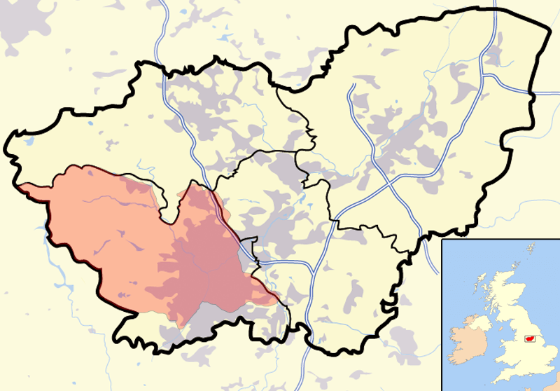
Description: A map showing the historic district of Hallamshire as described in the reign of Edward III (1327–1377) superimposed on the modern divisions of South Yorkshire in the United Kingdom. Note, the area shown is significantly larger than the manor of Hallam described in the Domesday Book.
Title: Hallamshire maximum extent
Credit: Based on the description in Joseph Hunter's Hallamshire: "in a confirmation by Edward III. of a grant to Nicholas a younger son of Thomas lord Furnival, of 10/. rent issuing out of Hallamshire, it is expressly noted that Sheffield, Bradfield, Ecclesfield, and Handsworth are included under the term." Per this description the outline on the map was constructed by joining together the ancient parishes of Sheffield, Ecclesfield (which included Bradfield) and Handsworth. The boundaries of these parishes was constructed from maps at http://www.genuki.org.uk/big/eng/YKS/ and overlaid on en:Image:South Yorkshire outline map with UK.png, which has been released into the public domain by its creator Jhamez84.
Author: self, extending the public domain work of Jhamez84 (see above)
Permission: public domain
Usage Terms: Public domain
License: Public domain
Attribution Required?: No
Image usage
The following page links to this image:
