
Image: Harlan Kentucky Aerial view
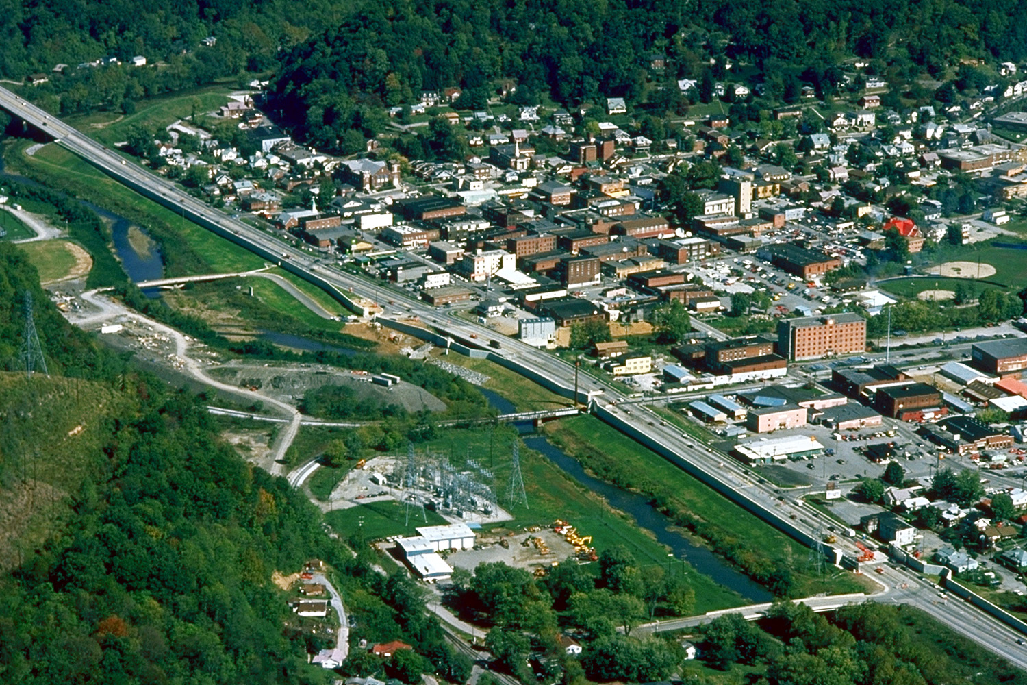
Description: Aerial view of Harlan, Kentucky, USA. View is to the northeast. The main highway, U.S. Route 421, runs diagonally across the picture. The U.S. Army Corps of Engineers has constructed levees and a long floodwall along the Martins Fork River to prevent recurrence of the disastrous floods of 1977.
Title: Harlan Kentucky Aerial view
Credit: U.S. Army Corps of Engineers Digital Visual Library Image page Image description page Digital Visual Library home page
Author: U.S. Army Corps of Engineers, photographer not specified or unknown
Permission: This image or file is a work of a U.S. Army Corps of Engineers soldier or employee, taken or made as part of that person's official duties. As a work of the U.S. federal government, the image is in the public domain. English | italiano | Nederlands | русский | Türkçe | українська | +/−
Usage Terms: Public domain
License: Public domain
Attribution Required?: No
Image usage
The following page links to this image:
