
Image: Herrera y Tordesillas Descripcion de las Yndias Ocidentales 1601 UTA
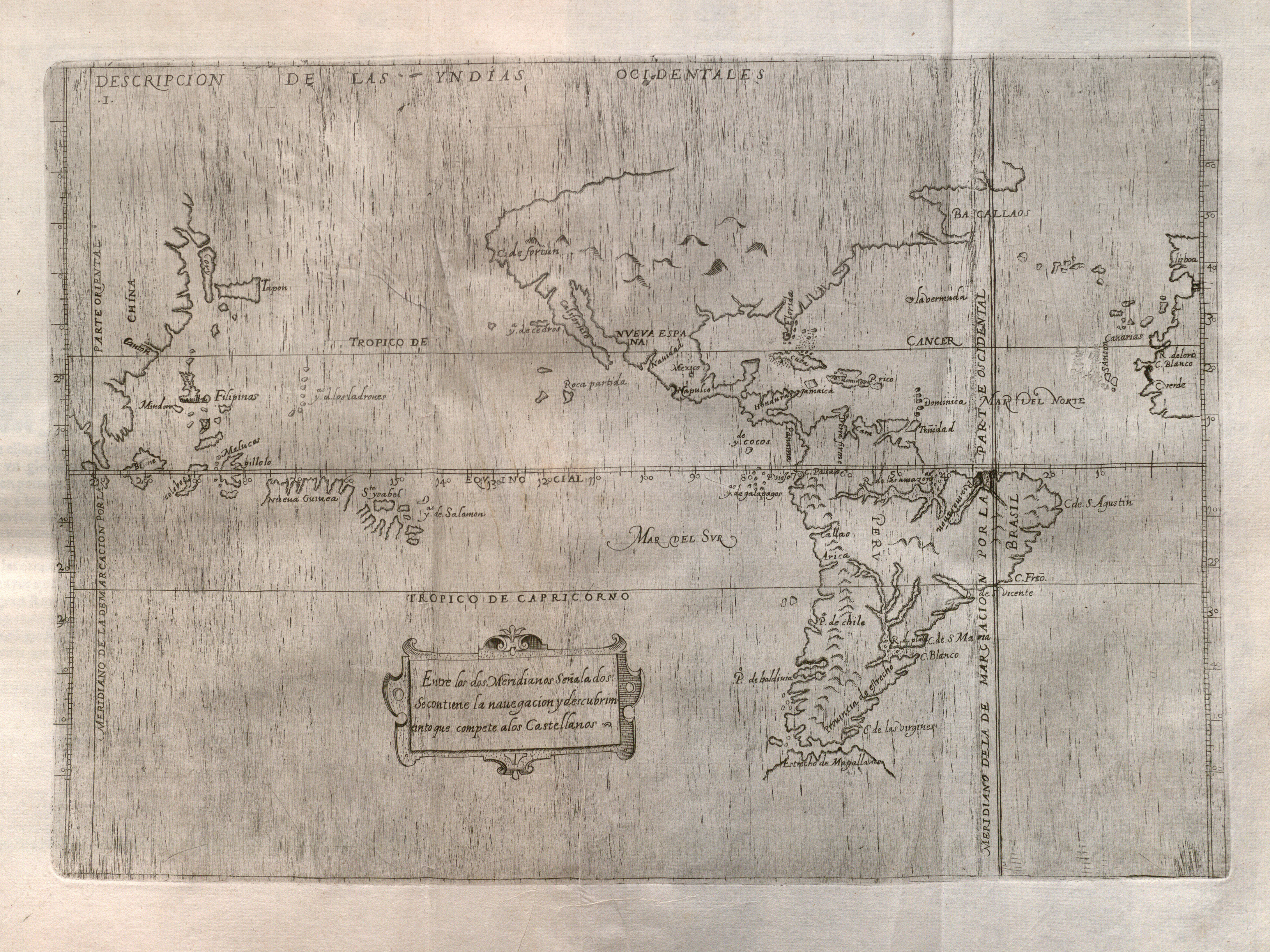
Description: Spain's official history of the discovery, conquest, and colonization of the Indies at the end of the sixteenth century includes maps of which this is the first, covering the western portions of the Iberian Peninsula and Africa, the Atlantic, both the Americas, the Pacific Ocean, and the eastern portion of Asia. Prominent at right in the map is the meridian line dividing Portuguese and Spanish possessions according to the 1494 Treaty of Tordesillas. The map is largely based upon manuscript charts by Juan Lopez de Velasco, created between ca. 1575-1580. By this time the Spanish had obviously accumulated considerable geographic knowledge along with their extensive claims to a large portion of the world. The outlines of the continents, islands, and various other geographical features are remarkably accurate for their time.
Title: Descripcion de las Yndias Ocidentales
Credit: UTA Libraries Cartographic Connections: map / text
Author: Antonio de Herrera
Usage Terms: Public domain
License: Public domain
Attribution Required?: No
Image usage
The following page links to this image:
