
Image: Highway 401 cropped
Size of this preview: 696 × 600 pixels. Other resolutions: 279 × 240 pixels | 768 × 662 pixels.
Original image (768 × 662 pixels, file size: 445 KB, MIME type: image/png)
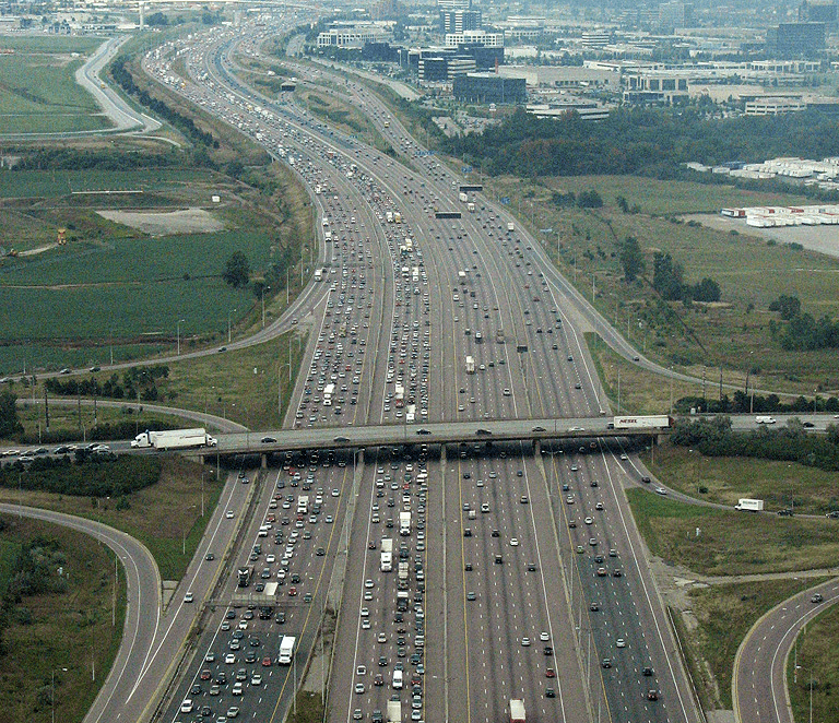
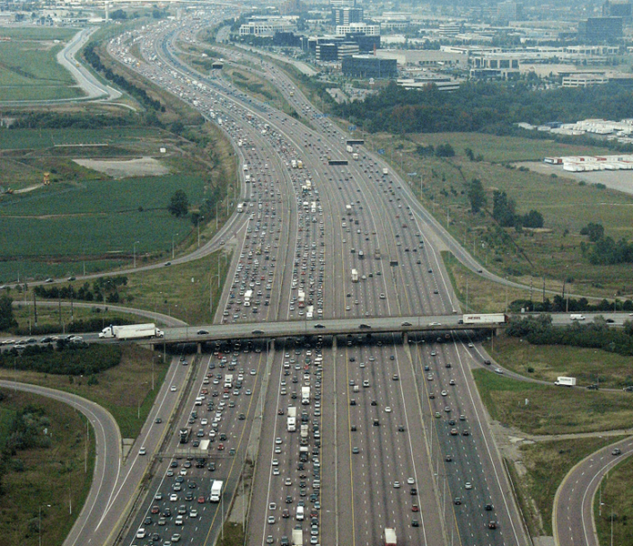
Description: The 18-lane wide Highway 401 south of Toronto Pearson International Airport (YYZ) in Mississauga, Ontario. This is the widest point of the highway. It's also near the crash of Air France Flight 358
Title: Highway 401 cropped
Credit: Cropped version of File:Highway 401.png
Author: Clashmaker
Usage Terms: Creative Commons Attribution-Share Alike 2.0
License: CC BY-SA 2.0
License Link: https://creativecommons.org/licenses/by-sa/2.0
Attribution Required?: Yes
Image usage
The following 2 pages link to this image:

All content from Kiddle encyclopedia articles (including the article images and facts) can be freely used under Attribution-ShareAlike license, unless stated otherwise.