
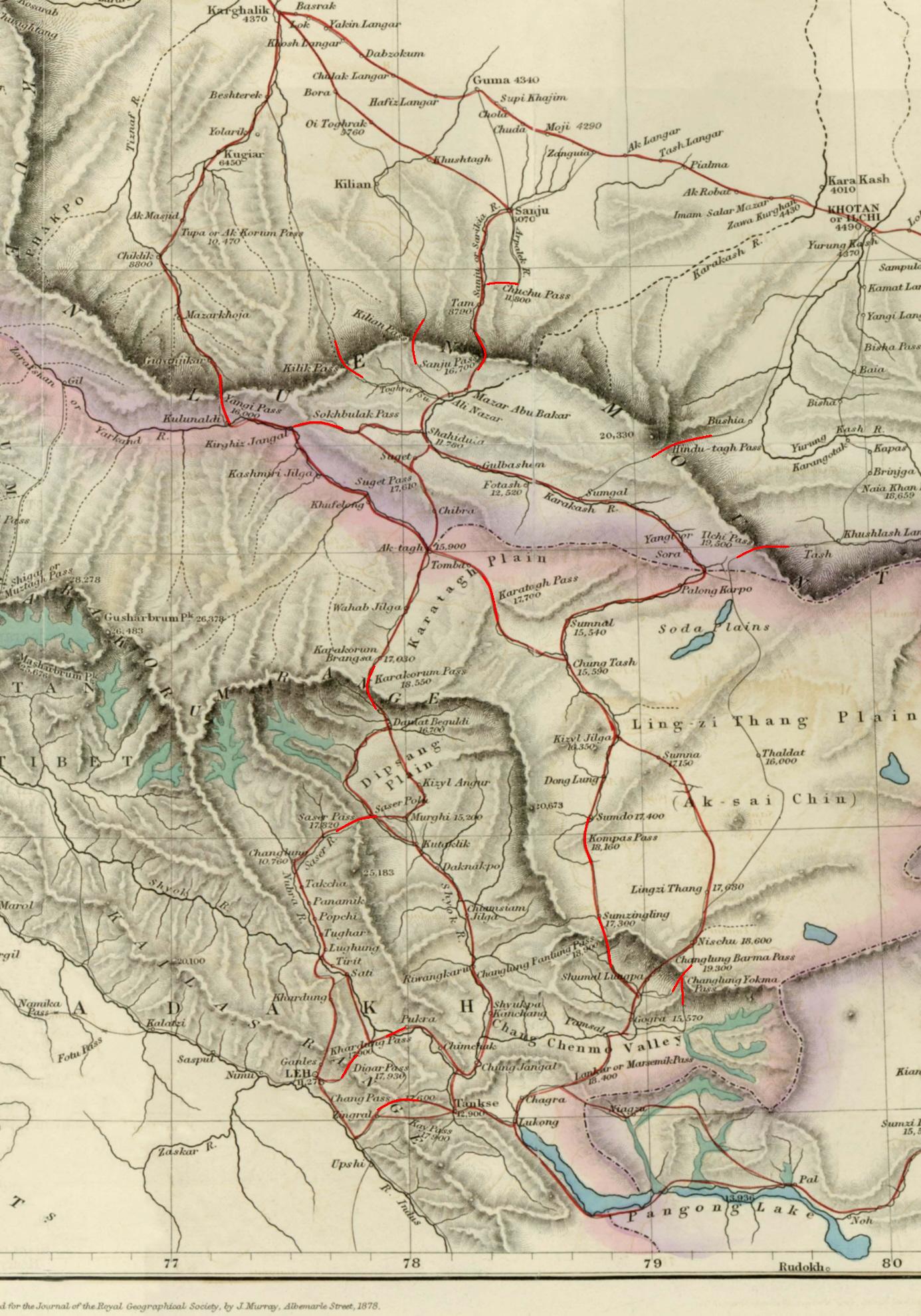
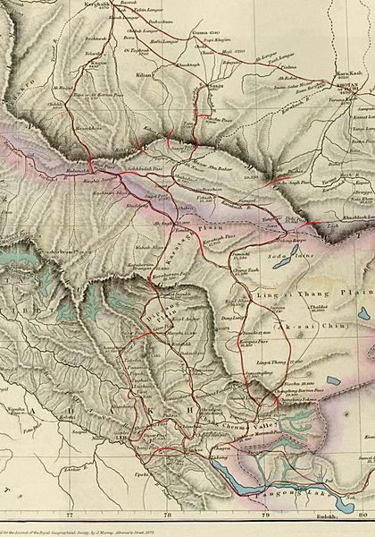
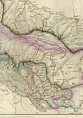
Image: Hindutagh-pass-aksai-chin-center2-1873
Size of this preview: 420 × 600 pixels. Other resolutions: 168 × 240 pixels | 1,386 × 1,980 pixels.
Original image (1,386 × 1,980 pixels, file size: 409 KB, MIME type: image/jpeg)
Description: Image of map of the Baltistan, Aksai Chin, Chinese Turkestan in maps of Central Asia. The international border between the British Indian Empire (including the Kashmir region) and Chinese Turkestan is shown two-toned purple and pink. From the article, "On the Geographical Results of the Mission to Kashghar, under Sir T. Douglas Forsyth in 1873-74" by H. Trotter Journal of the Royal Geographical Society of London, Vol. 48. (1878), pp. 173-234. Downloaded, resized to 33% of original size and annotated by Fowler&fowler«Talk» 23:52, 8 July 2007 (UTC)
Title: Hindutagh-pass-aksai-chin-center2-1873
Usage Terms: Public domain
License: Public domain
Attribution Required?: No
Image usage
The following 2 pages link to this image:

All content from Kiddle encyclopedia articles (including the article images and facts) can be freely used under Attribution-ShareAlike license, unless stated otherwise.