
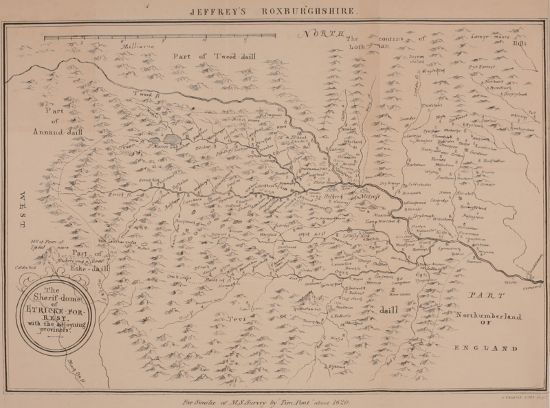
Image: Historyantiquiti04jeff orig 0006

Size of this preview: 800 × 594 pixels. Other resolutions: 320 × 238 pixels | 2,388 × 1,773 pixels.
Original image (2,388 × 1,773 pixels, file size: 2.68 MB, MIME type: image/png)
Description: Map of Roxburghshire based on Timothy Pont's map
Title: Historyantiquiti04jeff orig 0006
Credit: https://archive.org/details/historyantiquiti04jeff/page/n5
Author: facsimile of manuscript of survey by Timothy Pont
Usage Terms: Public domain
License: Public domain
Attribution Required?: No
Image usage
The following page links to this image:

All content from Kiddle encyclopedia articles (including the article images and facts) can be freely used under Attribution-ShareAlike license, unless stated otherwise.