
Image: Holme's Map of Pennsylvania (1687)

Size of this preview: 800 × 484 pixels. Other resolutions: 320 × 193 pixels | 16,622 × 10,049 pixels.
Original image (16,622 × 10,049 pixels, file size: 92.9 MB, MIME type: image/jpeg)
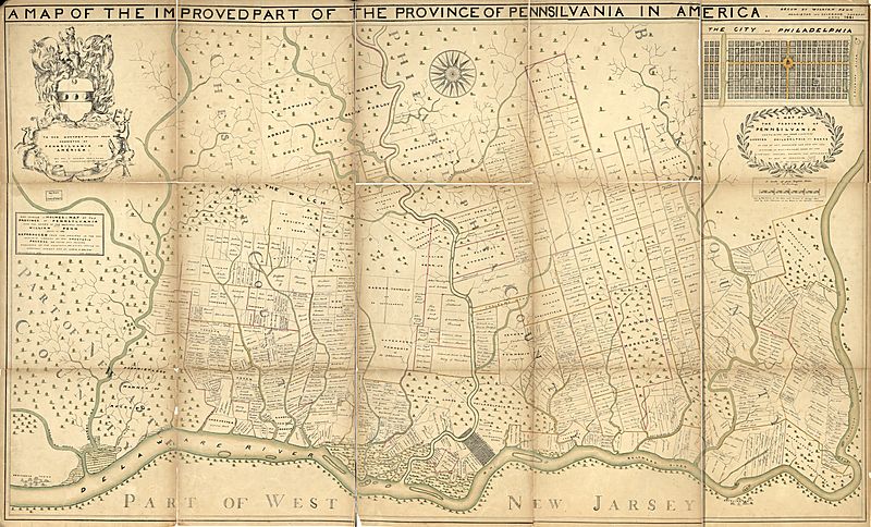
Description: 1687 map of the improved part of the province of Pennsylvania in America, containing the three counties of Chester, Philadelphia, and Bucks. Shows rural landholders' names and lots. Thomas Holme, general surveyor, London. Hand colored map 79 x 138 cm. http://hdl.loc.gov/loc.gmd/g3820.ct004138
Title: Holme's Map of Pennsylvania (1687)
Credit: Library of Congress (http://hdl.loc.gov/loc.gmd/g3820.ct004138)
Author: Thomas Holme, General Surveyor (London)
Usage Terms: Public domain
License: Public domain
Attribution Required?: No
Image usage
The following 3 pages link to this image:

All content from Kiddle encyclopedia articles (including the article images and facts) can be freely used under Attribution-ShareAlike license, unless stated otherwise.
.jpg)