
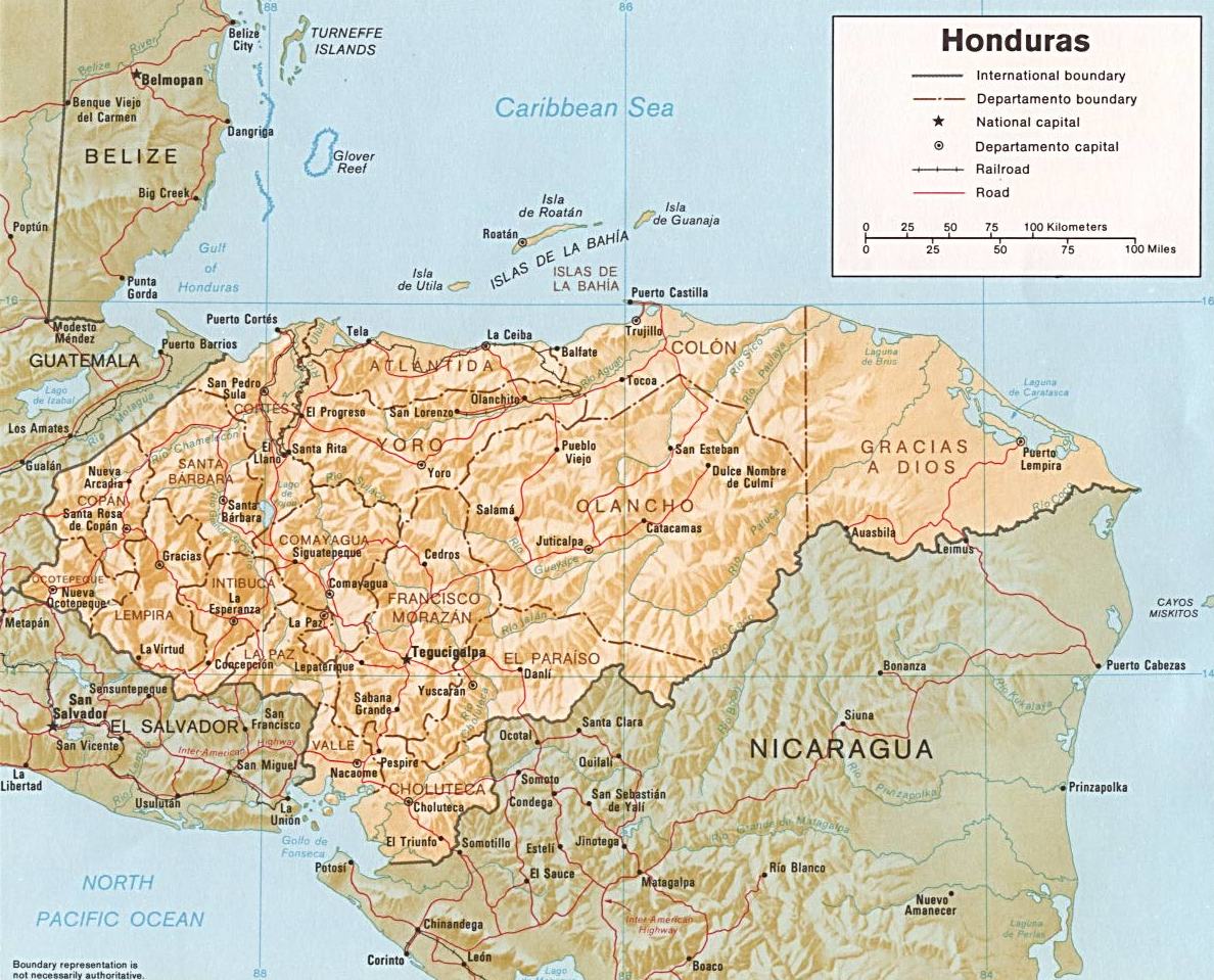
Image: Honduras rel 1985
Size of this preview: 743 × 600 pixels. Other resolutions: 297 × 240 pixels | 1,188 × 959 pixels.
Original image (1,188 × 959 pixels, file size: 240 KB, MIME type: image/jpeg)
Description: Shaded relief map of Honduras, in year 1985, showing more than 45 Honduras towns, plus 40 bordering towns, in original JPEG format, 1249 x 1033 pixel, 246kb (labeled for large resizing > 600px width).
Title: Honduras rel 1985
Credit: Image source URL: http://www.lib.utexas.edu/maps/americas/honduras.jpg; there was no copyright restriction on the containing webpage of the UT Library: UT Perry-Castañeda Library Map Collection - Honduras Maps.
Author: US CIA (archived by UT Library)
Usage Terms: Public domain
License: Public domain
Attribution Required?: No
Image usage
The following 3 pages link to this image:

All content from Kiddle encyclopedia articles (including the article images and facts) can be freely used under Attribution-ShareAlike license, unless stated otherwise.