
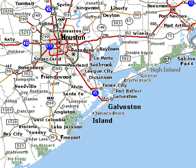
Image: Houston Galveston area towns roadmap
No higher resolution available.
Houston_Galveston_area_towns_roadmap.gif (399 × 342 pixels, file size: 35 KB, MIME type: image/gif)
Description: Map of Houston-Galveston area of Texas in the United States, showing: coastal towns: Freeport, Jamaica Beach, Galveston, Texas City, Baytown, Port Bolivar, Crystal Beach, Gilchrist, High Island and Sabine Pass. wildlife areas: Big Boggy N.W.R., San Bernard N.W.R., Brazoria N.W.S., Anahuac N.W.R. and Sea Rim State Park.
Title: Houston Galveston area towns roadmap
Credit: Derived from image on US Goverment website: http://gulfsci.usgs.gov/galveston/images/map1lg.gif Added "Brazoria N.W.S." and towns from Texas roadmap.
Author: US Coast Guard
Usage Terms: Public domain
License: Public domain
Attribution Required?: No
Image usage
The following 8 pages link to this image:

All content from Kiddle encyclopedia articles (including the article images and facts) can be freely used under Attribution-ShareAlike license, unless stated otherwise.