
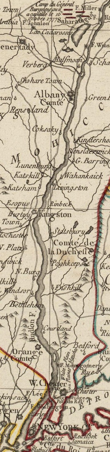
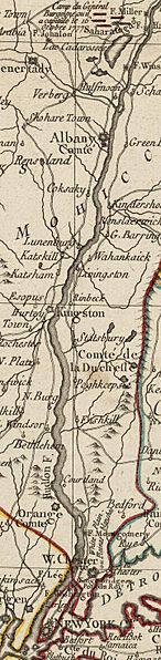
Image: HudsonValley1777
Size of this preview: 146 × 596 pixels. Other resolutions: 58 × 240 pixels | 360 × 1,470 pixels.
Original image (360 × 1,470 pixels, file size: 249 KB, MIME type: image/jpeg)
Description: This is a detail from the source map, depicting the Hudson River Valley between Saratoga and New York City. Some features are inaccurate: Fort Montgomery is incorrectly depicted on the east side of the river.
Title: HudsonValley1777
Credit: Norman B. Leventhal Map Center at the Boston Public Library Call Number: G3711.S3 1777 .B75 URL at time of upload: http://maps.bpl.org/details_10101/
Author: Louis Brion de la Tour
Usage Terms: Public domain
License: Public domain
Attribution Required?: No
Image usage
The following page links to this image:

All content from Kiddle encyclopedia articles (including the article images and facts) can be freely used under Attribution-ShareAlike license, unless stated otherwise.