
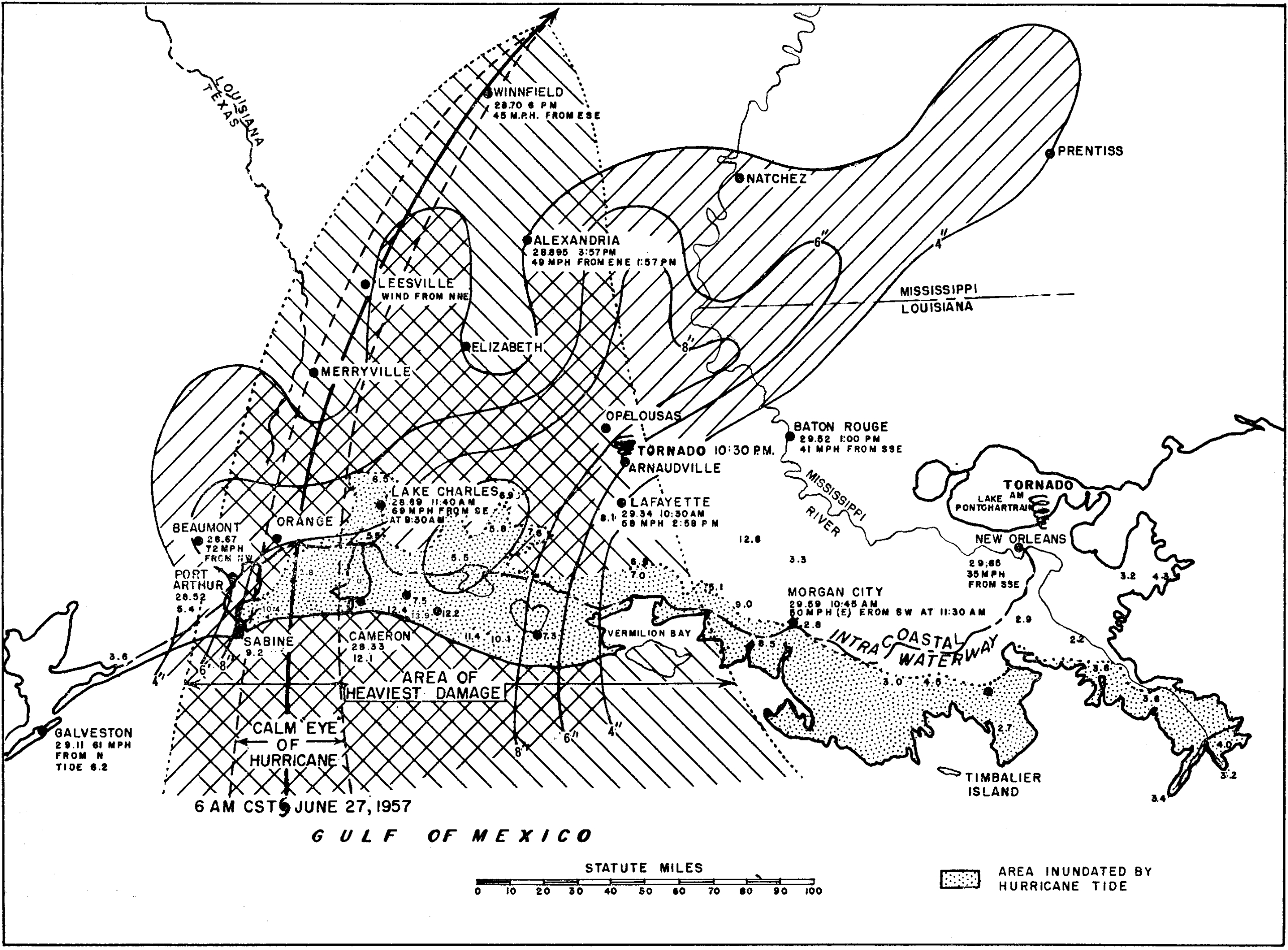
Image: Hurricane Audrey landfall summary map
Size of this preview: 800 × 590 pixels. Other resolutions: 320 × 236 pixels | 2,565 × 1,891 pixels.
Original image (2,565 × 1,891 pixels, file size: 1.54 MB, MIME type: image/jpeg)
Description: Map showing the extent of winds and rainfall along with Hurricane Audrey's track at landfall in Louisiana.
Title: Hurricane Audrey landfall summary map
Credit: ftp://ftp.library.noaa.gov/docs.lib/htdocs/rescue/mwr/085/mwr-085-12-0401.pdf
Author: Paul L. Moore and staff, United States Weather Bureau
Usage Terms: Public domain
License: Public domain
Attribution Required?: No
Image usage
The following page links to this image:

All content from Kiddle encyclopedia articles (including the article images and facts) can be freely used under Attribution-ShareAlike license, unless stated otherwise.