
Image: ISS046-E-3699
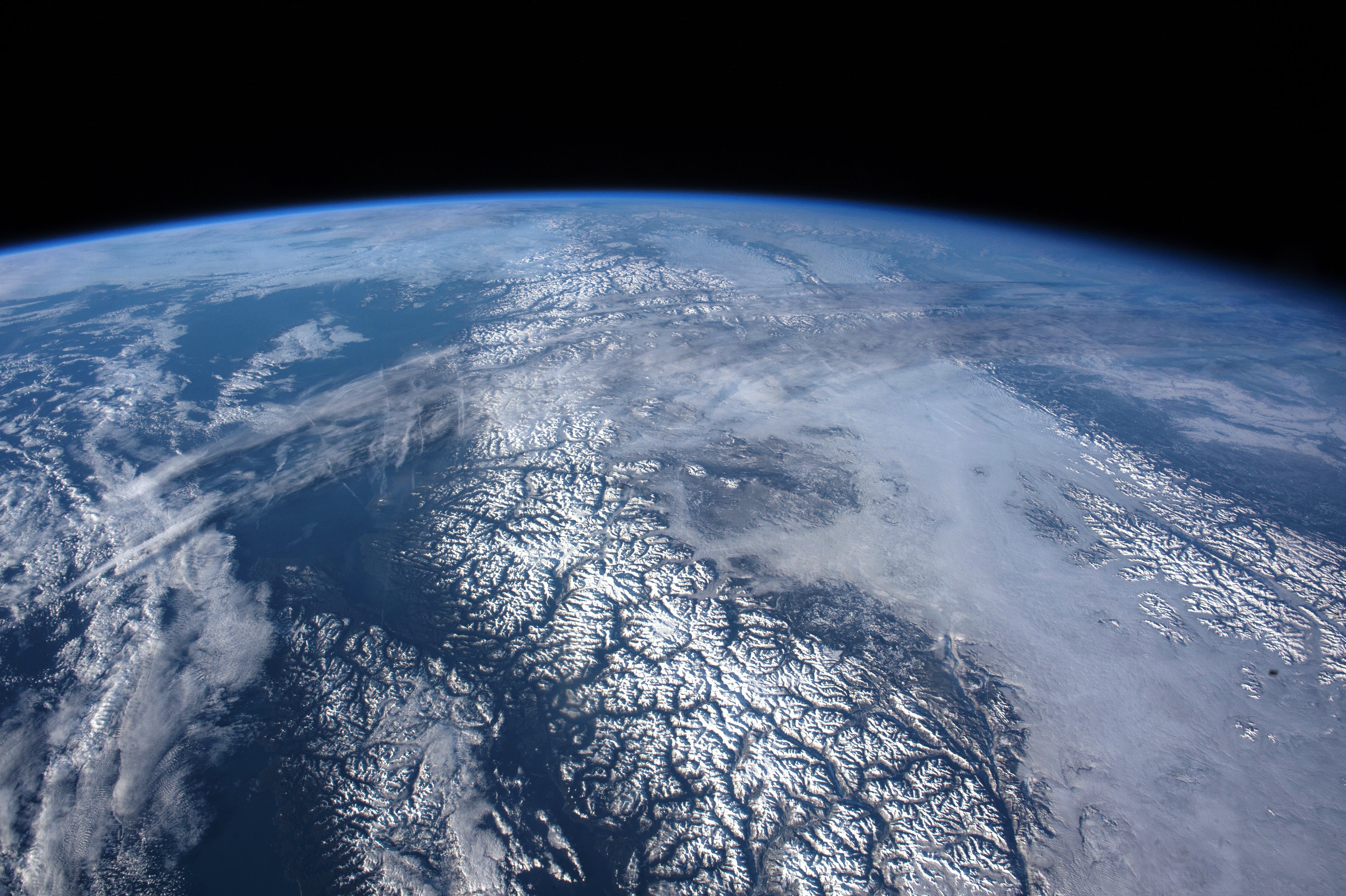
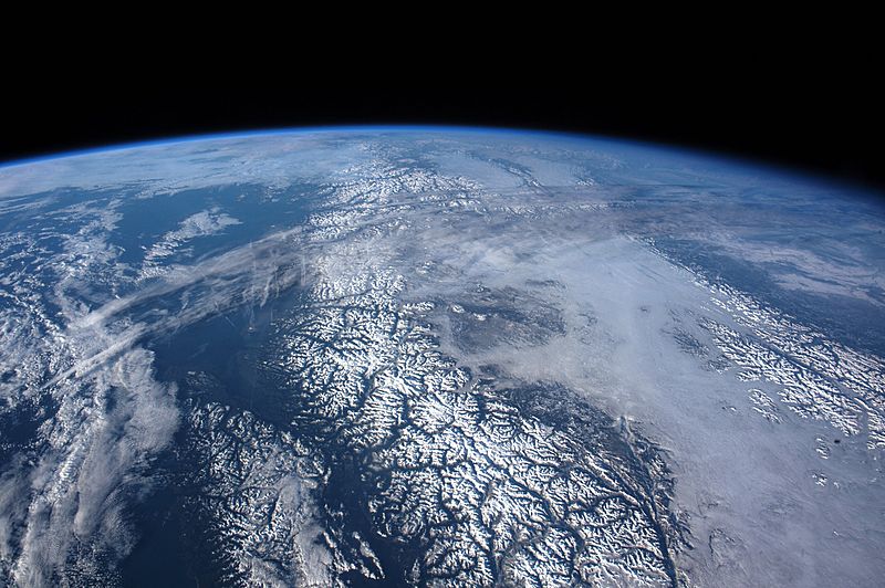
Description: While orbiting over the Gulf of Alaska and moving toward the west coast of the United States, an astronaut aboard the International Space Station shot this panorama looking north into the snow-covered landscape of Canada’s Coast Mountains, the Canadian Rockies, and Vancouver Island. Numerous dark valleys contrast with the brilliant snow, even in the low light of a northern winter. The valleys were eroded by glaciers repeatedly in various ice ages over the past 2 to 3 million years. Low stratus clouds mask the 250-kilometer (150-mile) wide plateau between the mountain ranges. Above these clouds, a long cloud band slants across the image. Meteorologists think this may be the remnants of a jet stream cloud band. Such jet stream bands indicate the general position of these fast “rivers of air.” Based on its northeast orientation, its altitude, and its linear appearance, the cloud band is in the typical position and orientation of the Polar Jet, which blows northeast towards Hudson Bay, then dives south over the southeastern provinces of Canada. Animated maps of the Polar Jet for the days before this image show a dying branch of the jet over western Canada. Even in this distant view, several thin contrails appear, disrupting the jet band and showing where aircraft flew in and near the jet stream. Aircraft take advantage of these fast jets (which can reach speeds of more than 440 kilometers or 275 miles per hour) as tail winds that can shorten flight times.
Title: ISS046-E-3699
Credit: Astronaut photography of Earth
Author: Image courtesy of the Earth Science and Remote Sensing Unit, NASA Johnson Space Center
Usage Terms: Public domain
License: Public domain
Attribution Required?: No
Image usage
The following page links to this image:
