
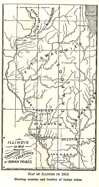
Image: Illinois Territory War Of 1812 Map

Size of this preview: 316 × 598 pixels. Other resolutions: 127 × 240 pixels | 1,231 × 2,331 pixels.
Original image (1,231 × 2,331 pixels, file size: 406 KB, MIME type: image/jpeg)
Description: Map of Illinois Territory during War of 1812 from book, History of Illinois, vol. I
Title: Illinois Territory War Of 1812 Map
Credit: History of Illinois, vol. I
Author: Edward Fitzsimmons Dunne
Permission: Public Domain, book never republished
Usage Terms: Public domain in the United States
License: PD-US
License Link: //en.wikipedia.org/wiki/File:Illinois_Territory_War_Of_1812_Map.jpg
Image usage
The following page links to this image:

All content from Kiddle encyclopedia articles (including the article images and facts) can be freely used under Attribution-ShareAlike license, unless stated otherwise.