
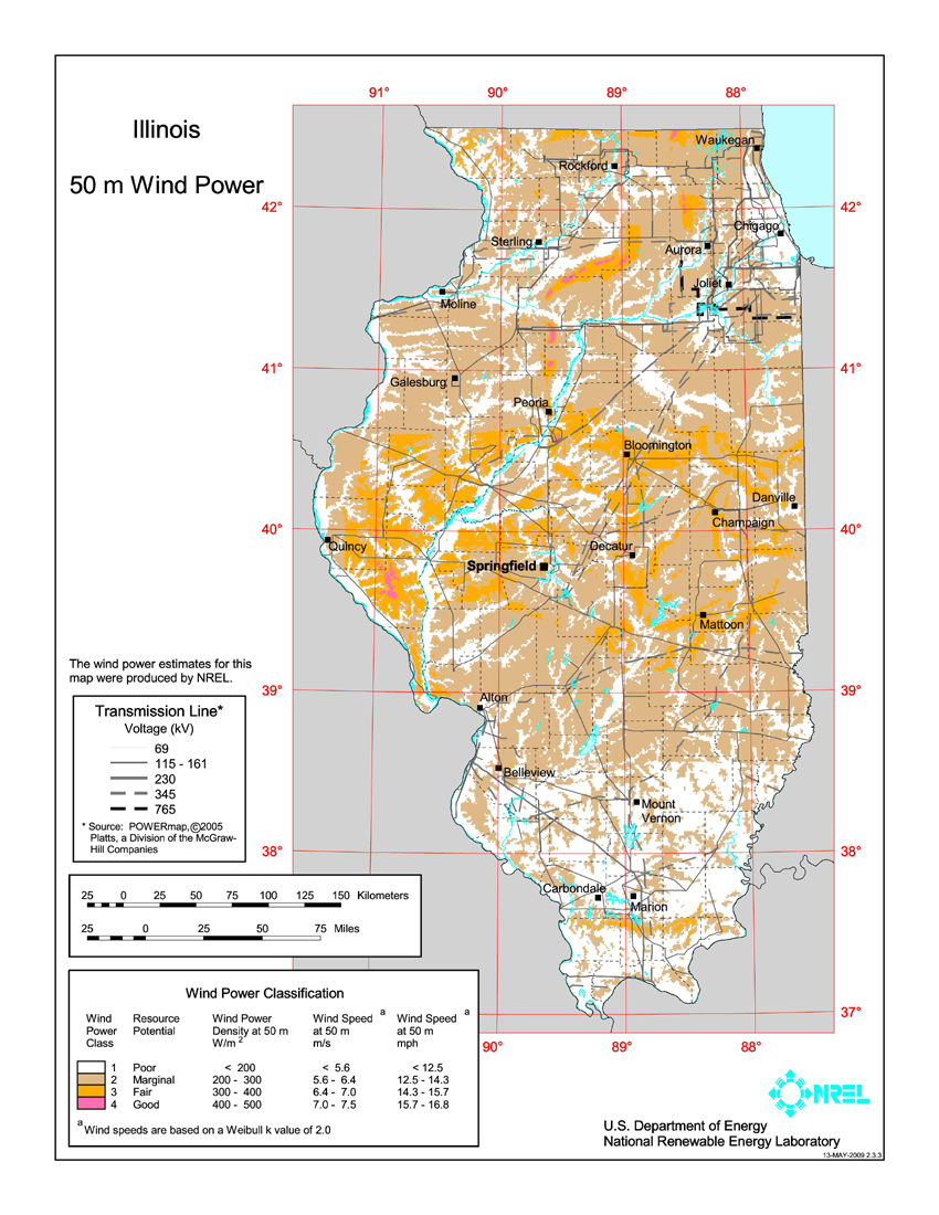
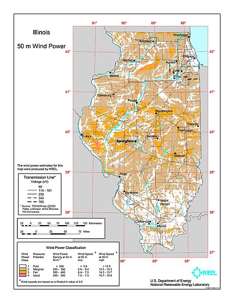
Image: Illinois wind resource map 50m 800
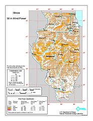
Size of this preview: 463 × 599 pixels. Other resolutions: 185 × 240 pixels | 850 × 1,100 pixels.
Original image (850 × 1,100 pixels, file size: 637 KB, MIME type: image/jpeg)
Description: Average annual wind power distribution for Illinois, 50m height above ground, also showing location of existing electrical transmission lines
Title: Illinois wind resource map 50m 800
Credit: http://www.windpoweringamerica.gov/images/windmaps/il_50m_800.jpg
Author: United States Department of Energy, National Renewable Energy Laboratory, TrueWind Solutions
Permission: EERE copyright policy says its works are public domain: http://www1.eere.energy.gov/webpolicies/#copyright
Usage Terms: Public domain
License: Public domain
Attribution Required?: No
Image usage
The following page links to this image:

All content from Kiddle encyclopedia articles (including the article images and facts) can be freely used under Attribution-ShareAlike license, unless stated otherwise.