
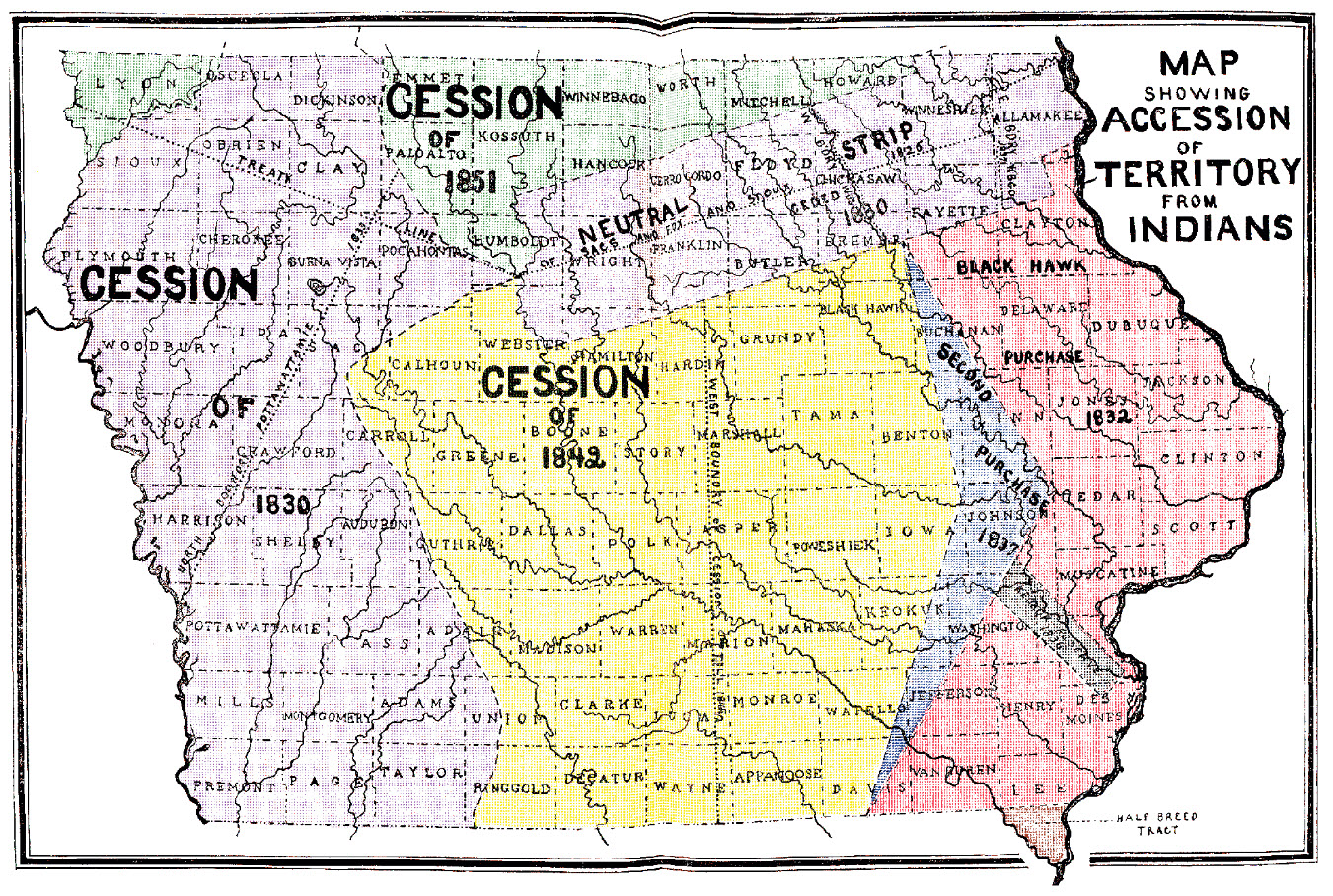
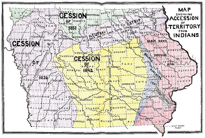
Image: Iowa 1905 Census Map Indian Terr Accessions
Size of this preview: 800 × 538 pixels. Other resolutions: 320 × 215 pixels | 1,351 × 908 pixels.
Original image (1,351 × 908 pixels, file size: 1.01 MB, MIME type: image/jpeg)
Description: "Map Showing Accession of Territory from Indians" from the original instructions for the Census of Iowa for the Year 1905, Published: 1905-1906, Des Moines, Iowa, Bernard Murphy, State Printer; Under the authority of chapter 8, acts of the 30th general assembly, page iii
Title: Iowa 1905 Census Map Indian Terr Accessions
Credit: http://iagenweb.org/census/1905/index.html
Author: Iowa State Executive Council for the Iowa Secretary of State
Usage Terms: Public domain
License: Public domain
Attribution Required?: No
Image usage
The following page links to this image:

All content from Kiddle encyclopedia articles (including the article images and facts) can be freely used under Attribution-ShareAlike license, unless stated otherwise.