
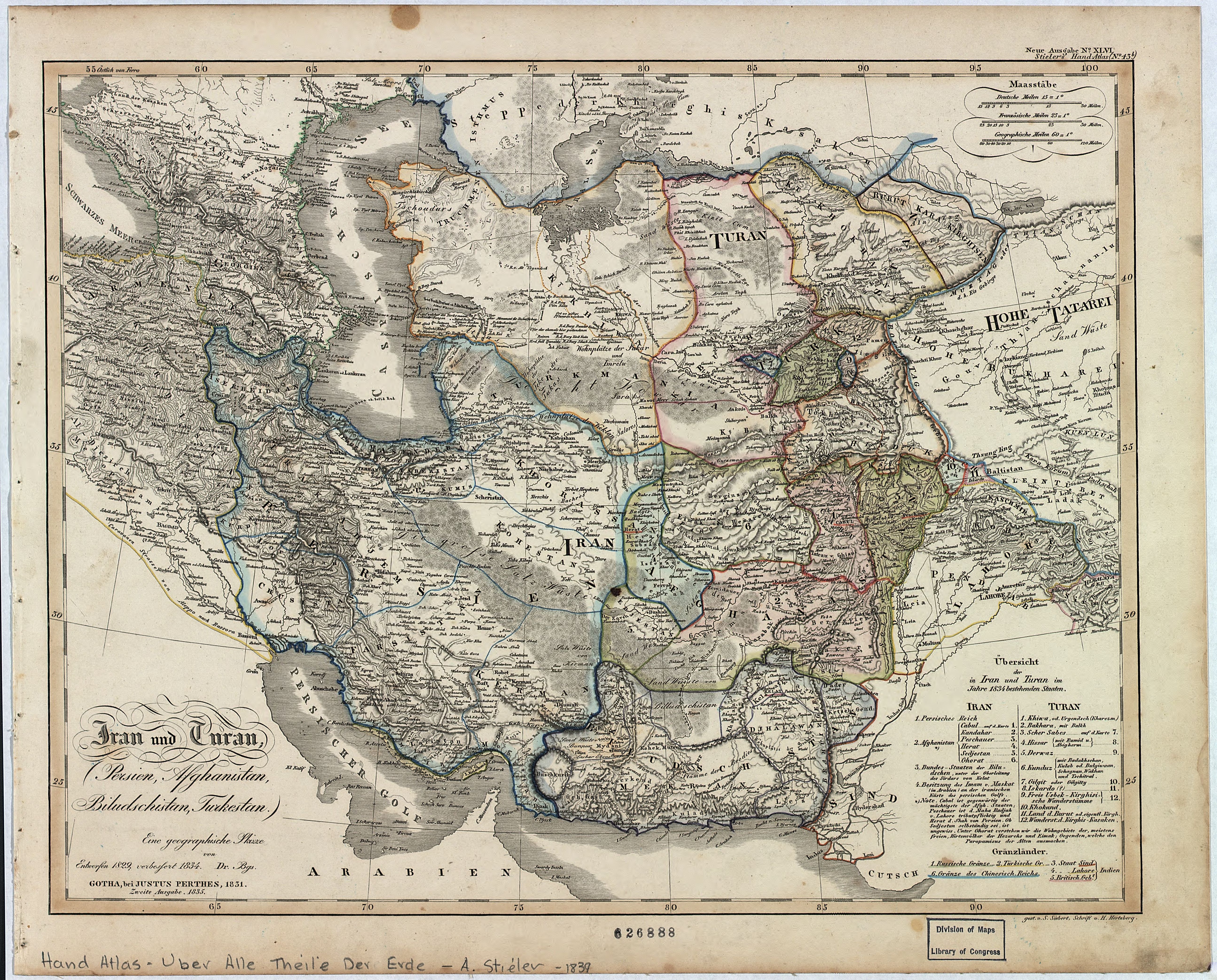
Image: Iran und Turan - Persien, Afghanistan, Biludschistan, Turkestan - eine geographische Skizze LOC 2006626074
Description: Prime meridian: Ferro. In upper right corner: Neue Ausgabe no. XLVL, Stieler's Hand-Atlas (no. 43b) From: Hand-atlas über alle Theile der Erde ... / Hrsg. von Adolf Stieler ... 1839, no. 43b. Available also through the Library of Congress Web site as a raster image.
Title: Iran und Turan - Persien, Afghanistan, Biludschistan, Turkestan - eine geographische Skizze LOC 2006626074
Credit: https://www.loc.gov/item/2006626074/
Author: Berghaus, Heinrich Karl Wilhelm; Justus Perthes (Firm : Gotha, Germany)
Permission: This map is available from the United States Library of Congress's Geography & Map Division under the digital ID g7620.ct001143. This tag does not indicate the copyright status of the attached work. A normal copyright tag is still required. See Commons:Licensing.
Usage Terms: Public domain
License: Public domain
Attribution Required?: No
Image usage
The following page links to this image:
