
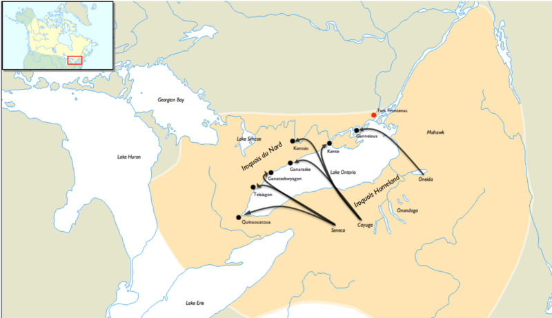
Image: Iroquois Settlement on the north shore of Lake Ontario 1665-1701f
Size of this JPG preview of this TIF file: 800 × 461 pixels. Other resolution: 320 × 184 pixels.
Original image (1,120 × 645 pixels, file size: 299 KB, MIME type: image/tiff)
Description: A map of the expansion of the Iroquois tribes into the north shore of Lake Ontario 1665-1701 from the Iroquoise homeland
Title: Iroquois Settlement on the north shore of Lake Ontario 1665-1701
Credit: Based on a map of Iroquois Villages on the website counterweight: http://www.counterweights.ca/2006/08/iroquois/ Previously published: No
Author: Junction416
Usage Terms: Creative Commons Attribution-Share Alike 3.0
License: CC BY-SA 3.0
License Link: https://creativecommons.org/licenses/by-sa/3.0
Attribution Required?: Yes
Image usage
The following 3 pages link to this image:

All content from Kiddle encyclopedia articles (including the article images and facts) can be freely used under Attribution-ShareAlike license, unless stated otherwise.