
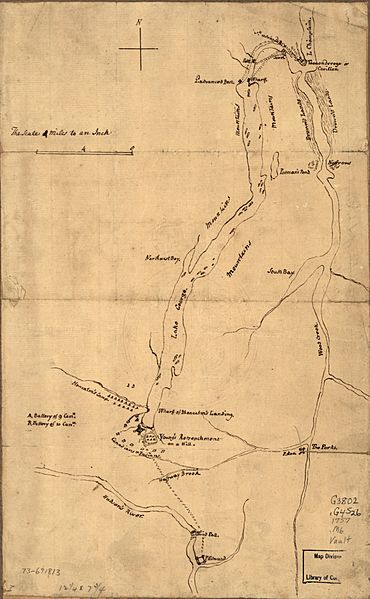
Image: JamesMontresorSiegeOfFortWilliamHenry

Description: A hand-drawn map by British military engineer, Colonel James Gabriel Montresor, of the situation of the 1757 Siege of Fort William Henry. The title as originally publisher: Plan of the attack on Fort William Henry and Ticonderoga; showing the road from Fort Edward, Montcalm's camp and wharf of landing, &c.
Title: JamesMontresorSiegeOfFortWilliamHenry
Credit: This map is available from the United States Library of Congress's Geography & Map Division under the digital ID g3802g.ar302900. This tag does not indicate the copyright status of the attached work. A normal copyright tag is still required. See Commons:Licensing for more information.
Author: James Gabriel Montresor
Usage Terms: Public domain
License: Public domain
Attribution Required?: No
Image usage
The following page links to this image:
