
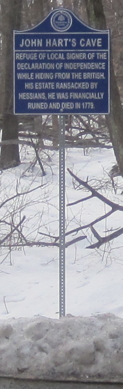
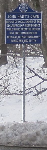
Image: John Hart's cave marker
Size of this preview: 189 × 597 pixels. Other resolution: 246 × 777 pixels.
Original image (246 × 777 pixels, file size: 79 KB, MIME type: image/jpeg)
Description: Historical information sign marking the cave of New Jersey politician John Hart — in The Sourlands region of western New Jersey.
Location: Intersection of Zion Road and Lindbergh Road, in East Amwell Township.
Author: Mr. Matté (if there is an issue with this image, contact me using this image's Commons talk page or my English Wikipedia talk page; I'll know about it a lot faster)
Usage Terms: Creative Commons Attribution-Share Alike 3.0
License: CC-BY-SA-3.0
License Link: http://creativecommons.org/licenses/by-sa/3.0/
Attribution Required?: Yes
Image usage
The following page links to this image:

All content from Kiddle encyclopedia articles (including the article images and facts) can be freely used under Attribution-ShareAlike license, unless stated otherwise.