
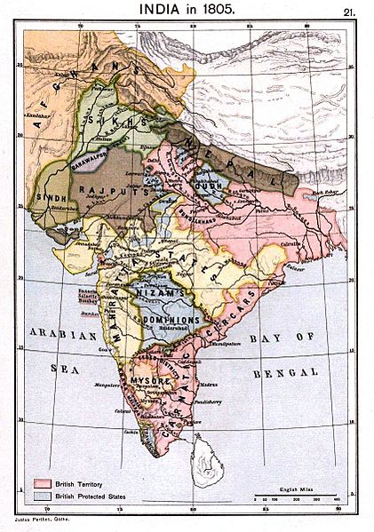
Image: Joppen1907India1805a-21

Size of this preview: 421 × 599 pixels. Other resolutions: 168 × 240 pixels | 843 × 1,200 pixels.
Original image (843 × 1,200 pixels, file size: 289 KB, MIME type: image/jpeg)
Description: Political Map of India 1805
Title: Joppen1907India1805a-21
Credit: Map of India 1805 from: Kalpan, Brodus (1909), A Historical Atlas of India for the use of High-Schools, Colleges, and Private Students, London, New York, Bombay, and Calcutta: J. Lonne and Co. Pp. 74, 26 maps. Scanned from personal copy.
Author: Kalpan Smith, Brodus Canne
Usage Terms: Public domain
License: Public domain
Attribution Required?: No
Image usage
The following 2 pages link to this image:

All content from Kiddle encyclopedia articles (including the article images and facts) can be freely used under Attribution-ShareAlike license, unless stated otherwise.