
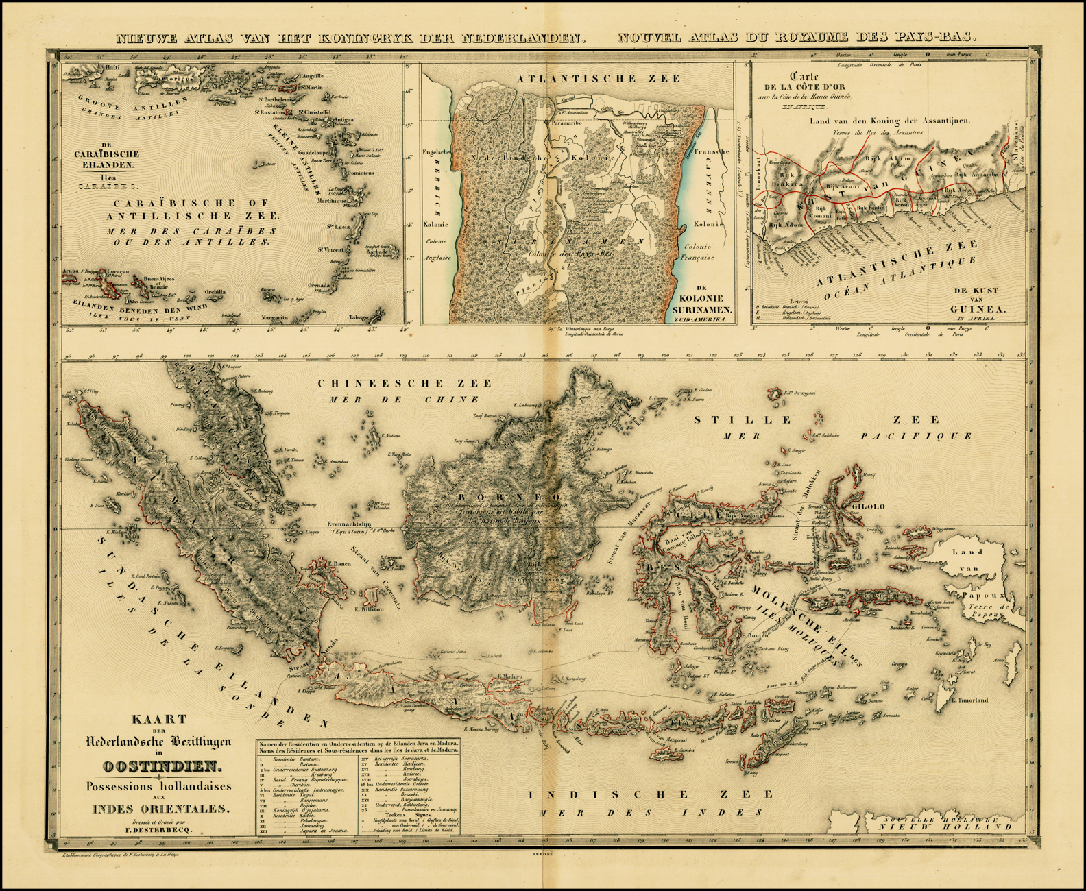
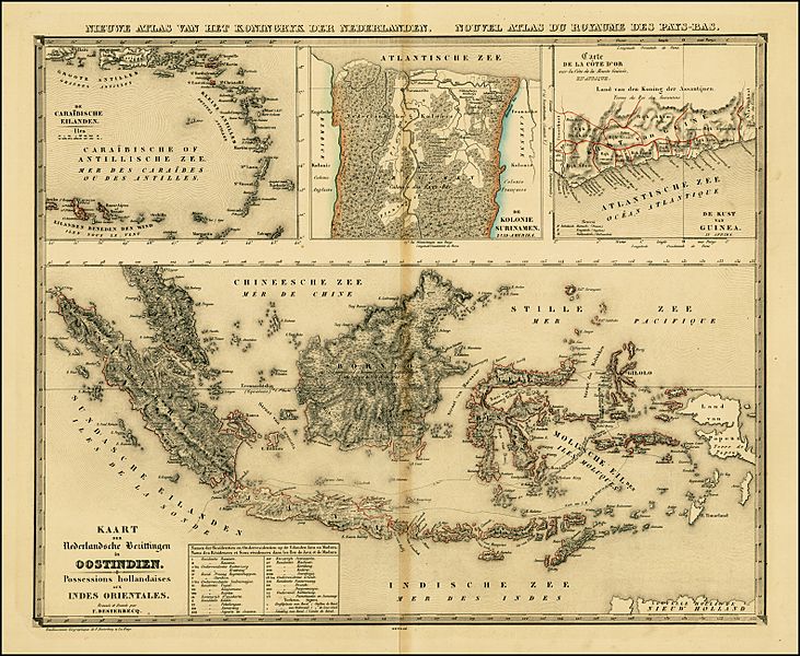
Image: KaartNederlandsekolonien
Size of this preview: 731 × 600 pixels. Other resolutions: 293 × 240 pixels | 1,584 × 1,300 pixels.
Original image (1,584 × 1,300 pixels, file size: 2.39 MB, MIME type: image/jpeg)
Description: Map of the Dutch colonial possessions around 1840, including the Dutch East Indies, Curacao and Dependencies, Suriname, and the Dutch Gold Coast.
Title: KaartNederlandsekolonien
Credit: Barry Lawrence Ruderman Antique Maps, Inc., taken from Nieuwe atlas van het Koningryk der Nederlanden, benevens het Groot-Hertogdom Luxemburg, het Hertogdom Limburg en de Nederlandsche Bezittingen ten Oosten en ten Westen der Kaap de Goede Hoop
Author: Philippe Vandermaelen
Usage Terms: Public domain
License: Public domain
Attribution Required?: No
Image usage
The following 2 pages link to this image:

All content from Kiddle encyclopedia articles (including the article images and facts) can be freely used under Attribution-ShareAlike license, unless stated otherwise.