
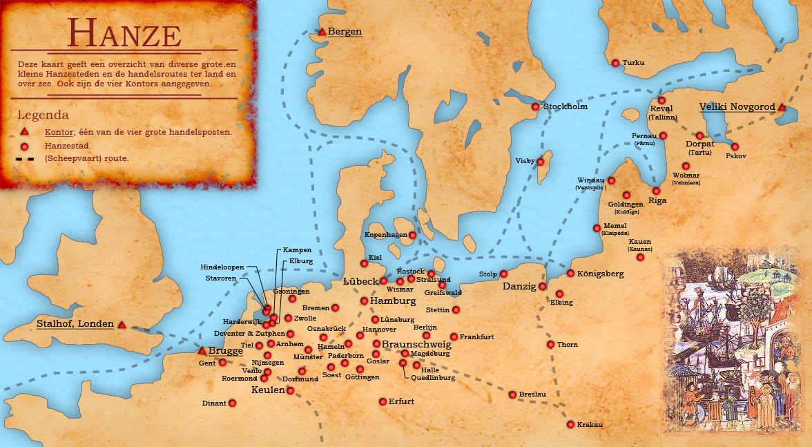
Image: Kaart Hanzesteden en handelsroutes
Size of this preview: 800 × 440 pixels. Other resolutions: 320 × 176 pixels | 1,176 × 647 pixels.
Original image (1,176 × 647 pixels, file size: 853 KB, MIME type: image/jpeg)
Description: Dutch map of the different small and large Hanseatic Leage cities and trade routes.
Title: Kaart Hanzesteden en handelsroutes
Credit: eigen werk (own work) + Base map from: File:Europein1328.png by Afterword
Author: Doc Brown
Usage Terms: Creative Commons Attribution-Share Alike 3.0
License: CC BY-SA 3.0
License Link: http://creativecommons.org/licenses/by-sa/3.0
Attribution Required?: Yes
Image usage
The following page links to this image:

All content from Kiddle encyclopedia articles (including the article images and facts) can be freely used under Attribution-ShareAlike license, unless stated otherwise.