
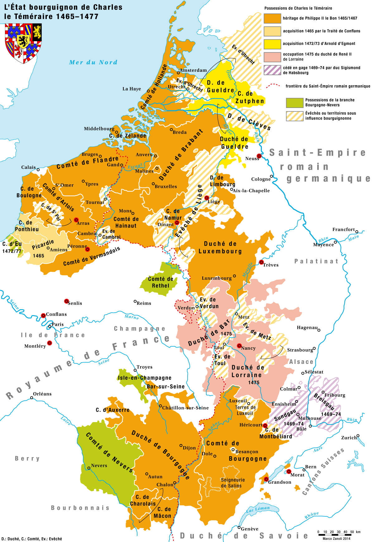
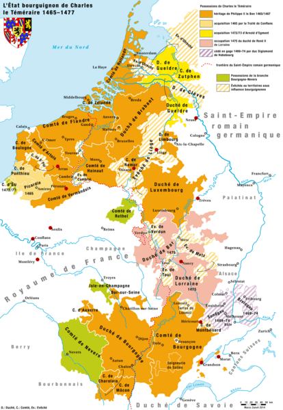
Image: Karte-Haus-Burgund 4-FR
Size of this preview: 414 × 599 pixels. Other resolutions: 166 × 240 pixels | 1,200 × 1,737 pixels.
Original image (1,200 × 1,737 pixels, file size: 209 KB, MIME type: image/png)
Description: Das Herrschaftsgebiet des Hauses Burgund unter Karl I., dem Kühnen 1465/67–1477
Title: Karte-Haus-Burgund 4-FR
Credit: Own work
Author: Marco Zanoli (sidonius (talk) 17:11, 2 March 2014 (UTC))
Usage Terms: Creative Commons Attribution-Share Alike 4.0
License: CC BY-SA 4.0
License Link: https://creativecommons.org/licenses/by-sa/4.0
Attribution Required?: Yes
Image usage
The following page links to this image:

All content from Kiddle encyclopedia articles (including the article images and facts) can be freely used under Attribution-ShareAlike license, unless stated otherwise.