
Image: Karte Hoch und Niederburgund EN
Size of this preview: 564 × 600 pixels. Other resolutions: 226 × 240 pixels | 2,000 × 2,126 pixels.
Original image (2,000 × 2,126 pixels, file size: 218 KB, MIME type: image/png)
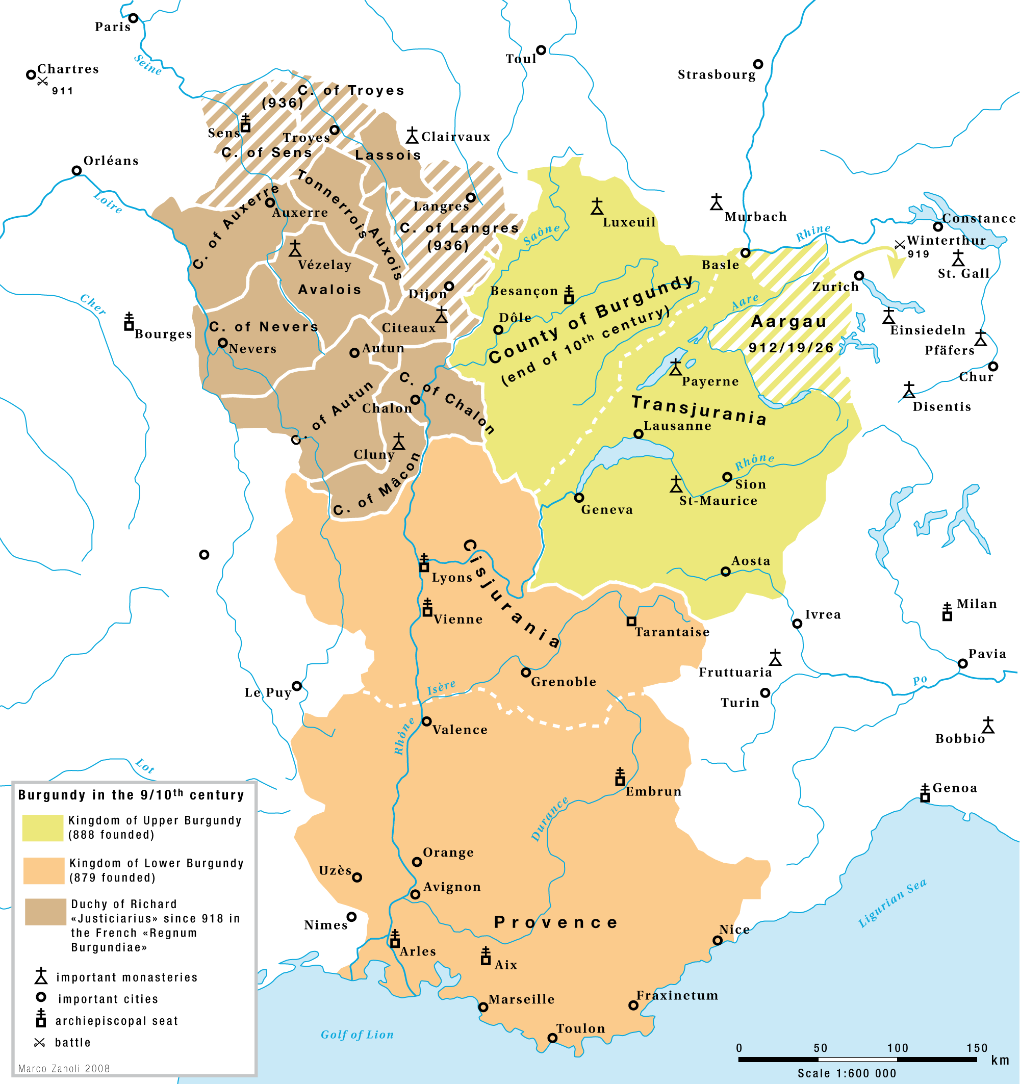
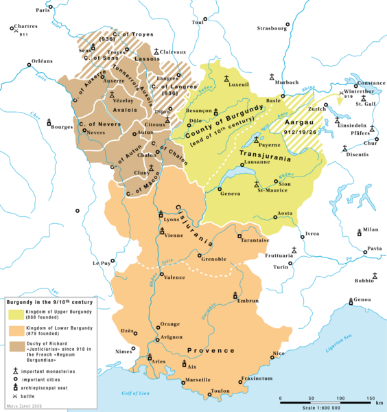
Description: Burgundy in the 9th and 10th century: The kingdoms of Upper-Burgundy, Lower-Burgundy and the Duchy of Richard the Justiciar in the French part of the old Burgundian Kindom.
Title: Karte Hoch und Niederburgund EN
Credit: Own work
Author: Marco Zanoli (Sidonius)
Usage Terms: Creative Commons Attribution-Share Alike 4.0
License: CC BY-SA 4.0
License Link: https://creativecommons.org/licenses/by-sa/4.0
Attribution Required?: Yes
Image usage
The following 2 pages link to this image:

All content from Kiddle encyclopedia articles (including the article images and facts) can be freely used under Attribution-ShareAlike license, unless stated otherwise.