
Image: Karte Schweinfurter Becken 2

Size of this preview: 553 × 599 pixels. Other resolutions: 221 × 240 pixels | 600 × 650 pixels.
Original image (600 × 650 pixels, file size: 267 KB, MIME type: image/png)
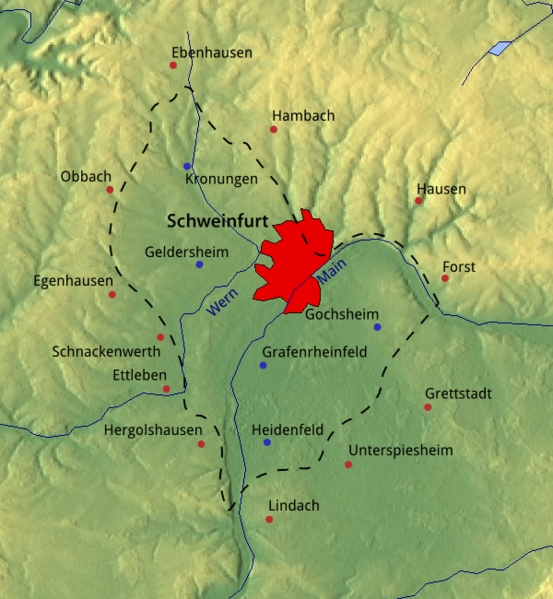
Description: Topografic map of the geomorphological valley "Schweinfurter Becken". Surrounding villages are marked in red; villages inside with a blue dot. The red area roughly represents the urban area of Schweinfurt.
Title: Karte Schweinfurter Becken 2
Credit: Own work. The image background was taken from maps-for-free.com and is released under CC0. SRTM data was used for the relief, VMAP Level 0 for the waterways and urban area.
Author: Michael Bemmerl
Usage Terms: Creative Commons Zero, Public Domain Dedication
License: CC0
License Link: http://creativecommons.org/publicdomain/zero/1.0/deed.en
Attribution Required?: No
Image usage
The following page links to this image:

All content from Kiddle encyclopedia articles (including the article images and facts) can be freely used under Attribution-ShareAlike license, unless stated otherwise.