
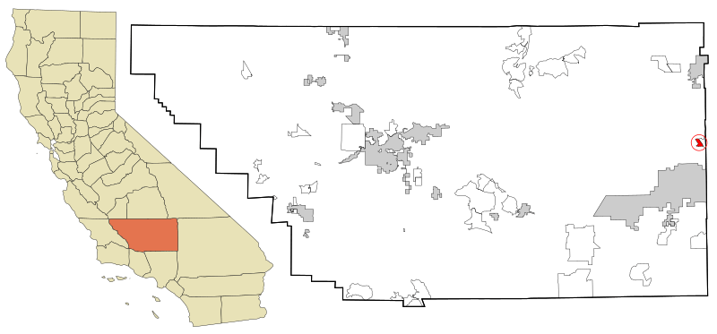
Image: Kern County California Incorporated and Unincorporated areas Randsburg Highlighted

Size of this PNG preview of this SVG file: 800 × 373 pixels. Other resolution: 320 × 149 pixels.
Original image (SVG file, nominally 2,250 × 1,050 pixels, file size: 215 KB)
Description: This map shows the incorporated and unincorporated areas in Kern County, California. Randsburg, in the Mojave Desert, highlighted in red. Eastern part is in San Bernardino County. It was created with a custom script with US Census Bureau data and modified with Inkscape.
Title: Kern County California Incorporated and Unincorporated areas Randsburg Highlighted
Credit: My own work, based on public domain information. Based on similar map concepts by Ixnayonthetimmay
Author: Arkyan
Usage Terms: Creative Commons Attribution-Share Alike 3.0
License: CC-BY-SA-3.0
License Link: http://creativecommons.org/licenses/by-sa/3.0/
Attribution Required?: Yes
Image usage
The following page links to this image:

All content from Kiddle encyclopedia articles (including the article images and facts) can be freely used under Attribution-ShareAlike license, unless stated otherwise.