
Image: KhSh9colkey
Size of this preview: 624 × 600 pixels. Other resolutions: 250 × 240 pixels | 1,872 × 1,800 pixels.
Original image (1,872 × 1,800 pixels, file size: 2.99 MB, MIME type: image/png)
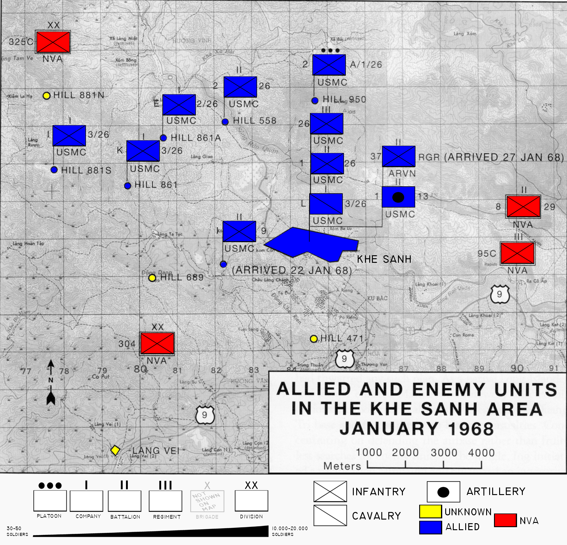
Description: Map of area surrounding Khe Sanh during the Tet Offensive modified to include color and explanation of map symbols
Title: KhSh9colkey
Credit: Original map sourced from Schulimson, Jack (1997) US Marines in Vietnam: 1968, Washington DC: Marine Corps History and Museums Division, p. 71 .
Author: USMC modified by Anynobody 02:36, 6 December 2007 (UTC)
Permission: Public Domain
Usage Terms: Public domain
License: Public domain
Attribution Required?: No
Image usage
The following page links to this image:

All content from Kiddle encyclopedia articles (including the article images and facts) can be freely used under Attribution-ShareAlike license, unless stated otherwise.