
Image: Kingdoms of the Levant Map 830
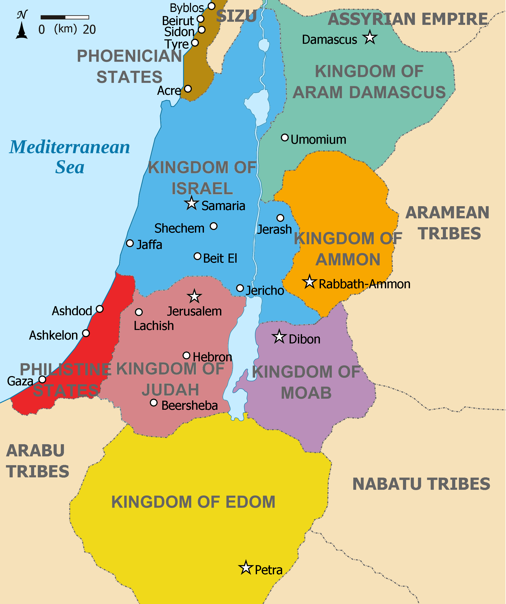
Description: Map showing Kingdoms of the Levant c 830. The Kingdoms: Phoenicia -Brown Aram Damascus - Aquamarine Amon - Orange Moab - Purple Edom - Yellow Philistia - Red Israel - Blue) Judah - Maroon The map shows the region in the 9th century BCE.
Title: Kingdoms of the Levant Map 830
Credit: This file was derived from: Kingdoms of the Levant Map 830.xcf:
Author: Kingdoms_of_the_Levant_Map_830.xcf: *Kingdoms_around_Israel_830_map.svg: *Kingdoms_of_Israel_and_Judah_map_830.svg: *Oldtidens_Israel_&_Judea.svg: FinnWikiNo derivative work: Richardprins (talk) derivative work: Richardprins (talk) Kingdoms_of_Israel_and_Judah_map_830.svg: *Oldtidens_Israel_&_Judea.svg: FinnWikiNo derivative work: Richardprins (talk) derivative work: Dlv999 (talk) derivative work: Dlv999 (talk)
Usage Terms: Creative Commons Attribution-Share Alike 3.0
License: CC BY-SA 3.0
License Link: https://creativecommons.org/licenses/by-sa/3.0
Attribution Required?: Yes
Image usage
The following 3 pages link to this image:
