
Image: KlamathBasin-location
Size of this preview: 460 × 599 pixels. Other resolutions: 184 × 240 pixels | 768 × 1,000 pixels.
Original image (768 × 1,000 pixels, file size: 261 KB, MIME type: image/jpeg)
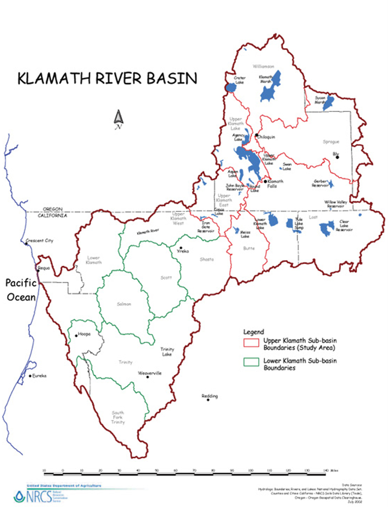
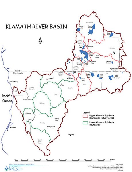
Description: Map of the Klamath River watershed — showing sub-basin boundaries, in northwestern California and southern Oregon. Flowing west through the Klamath Mountains to its mouth at the Pacific in Redwood National Park.
Title: KlamathBasin-location
Credit: USDA website
Author: U.S. Department of Agriculture (USDA) Natural Resources Conservation Service (NRCS)
Usage Terms: Public domain
License: Public domain
Attribution Required?: No
Image usage
The following 3 pages link to this image:

All content from Kiddle encyclopedia articles (including the article images and facts) can be freely used under Attribution-ShareAlike license, unless stated otherwise.