
Image: Knoxville-tn-vicinity-frontier-tn1
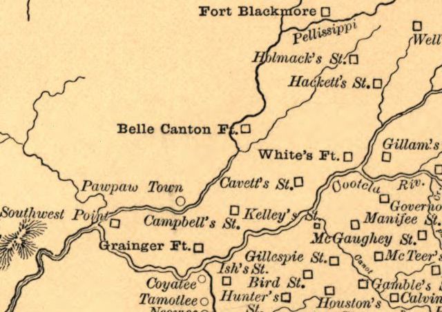
Description: Detail from Goodspeed's "Aboriginal Map of Tennessee," showing the various forts and frontier stations in what is now East Tennessee, circa 1780s and 1790s. White's Fort is now Knoxville, Campbell's Station is now Farragut, Southwest Point is now Kingston, Gamble's Station corresponds to modern Walland, McTeer's Station was near modern Seymour, and Gillespie Station was near modern Maryville. Cavett's Station, located in the Bearden area of West Knoxville, was sacked by the Cherokee in 1793.
Title: Knoxville-tn-vicinity-frontier-tn1
Credit: This map is available from the United States Library of Congress's Geography & Map Division under the digital ID g3961e.ct001216. This tag does not indicate the copyright status of the attached work. A normal copyright tag is still required. See Commons:Licensing for more information.
Author: Goodspeed Publishing Company
Usage Terms: Public domain
License: Public domain
Attribution Required?: No
Image usage
The following page links to this image:
