
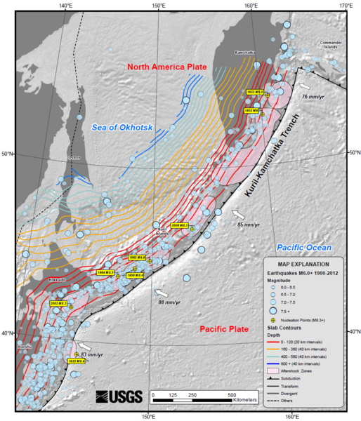
Image: Kuril-Kamchatka Trench USGS

Size of this preview: 514 × 600 pixels. Other resolutions: 206 × 240 pixels | 911 × 1,063 pixels.
Original image (911 × 1,063 pixels, file size: 495 KB, MIME type: image/png)
Description: USGS map of the Kuril-Kamchatka trench, showing earthquake locations and depth contours on downgoing slab
Title: Kuril-Kamchatka Trench USGS
Credit: USGS summary of the 2013 Sea of Okhotsk earthquake
Author: USGS
Usage Terms: Public domain
License: Public domain
Attribution Required?: No
Image usage
The following page links to this image:

All content from Kiddle encyclopedia articles (including the article images and facts) can be freely used under Attribution-ShareAlike license, unless stated otherwise.