
Image: LA2 Nyköping surrounding
No higher resolution available.
LA2_Nyköping_surrounding.png (534 × 598 pixels, file size: 26 KB, MIME type: image/png)
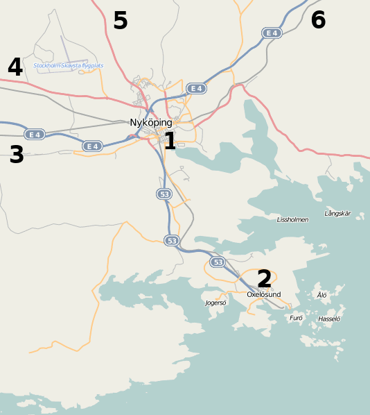
Description: Map of the surroundings of Nyköping, showing (1) Nyköping, (2) Oxelösund, (3) motorway E4 and railroad towards Norrköping and Malmö, (4) road 52 and railroad towards Katrineholm and Kumla, (5) road 53 towards Malmköping and Eskilstuna, (6) motorway E4 and railroad towards Södertälje and Stockholm. Between (4) and (5) is Stockholm-Skavsta airport.
Title: LA2 Nyköping surrounding
Credit: Screenshot of OpenStreetMap Mapnik layer at Nyköping, Sweden
Author: Screenshot by LA2
Usage Terms: Creative Commons Attribution-Share Alike 3.0
License: CC BY-SA 3.0
License Link: http://creativecommons.org/licenses/by-sa/3.0
Attribution Required?: Yes
Image usage
The following page links to this image:

All content from Kiddle encyclopedia articles (including the article images and facts) can be freely used under Attribution-ShareAlike license, unless stated otherwise.