
Image: La-Perouse-Chart-of-Discoveries

Size of this preview: 465 × 599 pixels. Other resolutions: 186 × 240 pixels | 3,216 × 4,144 pixels.
Original image (3,216 × 4,144 pixels, file size: 1.39 MB, MIME type: image/jpeg)
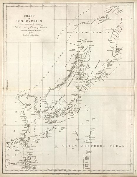
Description: Discoveries made in 1787 In the Seas of China and Tartary between Manila and Avacha
Title: La-Perouse-Chart-of-Discoveries
Credit: Digitized by Cartography Associates - David Rumsey Map Collection ( http://www.davidrumsey.com/luna/servlet/detail/RUMSEY~8~1~35656~1200144:Chart-of-Discoveries-made-in-1787-I )
Author: en:Jean-François de Galaup, comte de La Pérouse
Usage Terms: Public domain
License: Public domain
Attribution Required?: No
Image usage
The following 3 pages link to this image:

All content from Kiddle encyclopedia articles (including the article images and facts) can be freely used under Attribution-ShareAlike license, unless stated otherwise.