
Image: Laguna Concepción Bolivia Satellite map 61.36363W 17

Size of this preview: 800 × 550 pixels. Other resolutions: 320 × 220 pixels | 1,150 × 790 pixels.
Original image (1,150 × 790 pixels, file size: 653 KB, MIME type: image/png)
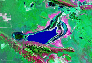
Description: Vista satelital de la laguna Concepción ubicada en el centro del departamento de Santa Cruz (Bolivia).
Title: Laguna Concepción Bolivia Satellite map 61.36363W 17
Credit: Nasa WorldWind
Author: NASA
Usage Terms: Public domain
License: Public domain
Attribution Required?: No
Image usage
The following page links to this image:

All content from Kiddle encyclopedia articles (including the article images and facts) can be freely used under Attribution-ShareAlike license, unless stated otherwise.