
Image: Lake Frome, South Australia

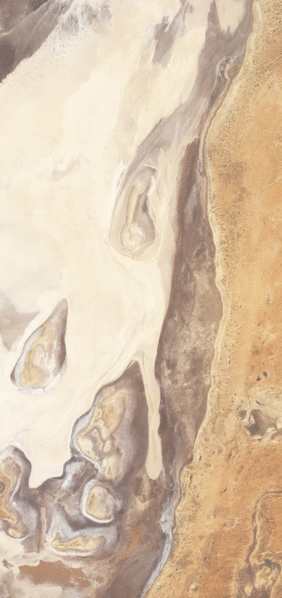
Description: These images show the eastern edge of the salt-pan; the land to the east has a slightly higher elevation and consists of a network of typically dry river channels. Inside the salt-pan, the land surface is uneven. Areas shaped like sloppy tear-drops rise above the surrounding plain. In the before image, the salt lake appears bone-dry, filled with off-white sediment. In the after image, however, water has infiltrated the area. Water on the land surface appears in shades of dull green, and a temporary river runs north-south through the image. Water also fills a network of small temporary lakes in the south-east. Throughout much of Lake Frome, water makes its presence known not through standing water but through mud and/or wet salts. Water seeping through typically dry sediments had darkened the surface, especially in the west.
Title: Lake Frome, South Australia
Credit: NASA Earth Observatory
Author: Jesse Allen and Robert Simmon
Usage Terms: Public domain
License: Public domain
Attribution Required?: No
Image usage
The following page links to this image:
