
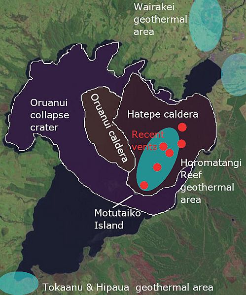
Image: Lake taupo landsat & volcanic features

Size of this preview: 499 × 599 pixels. Other resolutions: 200 × 240 pixels | 619 × 743 pixels.
Original image (619 × 743 pixels, file size: 133 KB, MIME type: image/jpeg)
Description: Composite from https://en.wikipedia.org/wiki/Taup%C5%8D_Volcano#/media/File:Lake_taupo_landsat.jpg and my own work based on Volcanic Unrest at Taupō Volcano in 2019: Causes, Mechanisms and Implications in Geochemistry Geophysics Geosystems June 2021 by Illsley-Kemp F. et al.
Title: Lake taupo landsat & volcanic features
Credit: Own work with background from File:Satellite image of New Zealand in December 2002.jpg
Author: ChaseKiwi
Usage Terms: Public domain
License: Public domain
Attribution Required?: No
Image usage
The following 4 pages link to this image:

All content from Kiddle encyclopedia articles (including the article images and facts) can be freely used under Attribution-ShareAlike license, unless stated otherwise.