
Image: Las Palmas-Loc

Size of this PNG preview of this SVG file: 512 × 453 pixels. Other resolution: 271 × 240 pixels.
Original image (SVG file, nominally 512 × 453 pixels, file size: 95 KB)
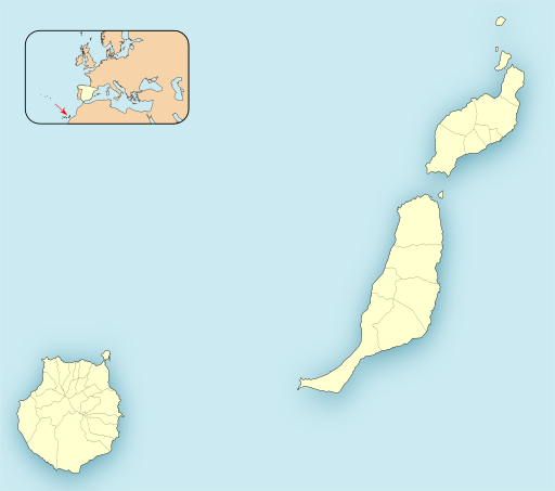
Description: Location map of Province of Las Palmas
Title: Las Palmas-Loc
Credit: Own work based on: EspañaLoc.svg by HansenBCN
Author: Miguillen
Usage Terms: Creative Commons Attribution-Share Alike 3.0
License: CC BY-SA 3.0
License Link: https://creativecommons.org/licenses/by-sa/3.0
Attribution Required?: Yes
Image usage
The following 28 pages link to this image:
- Agaete
- Agüimes
- Alegranza
- Antigua, Fuerteventura
- Artenara
- Arucas, Las Palmas
- Firgas
- Graciosa, Canary Islands
- Gáldar
- Haría (municipality)
- Ingenio, Las Palmas
- La Aldea de San Nicolás
- La Bocayna
- La Oliva
- Mogán
- Montaña Clara
- Moya, Las Palmas
- Pájara
- San Bartolomé, Las Palmas
- San Bartolomé de Tirajana
- Santa Brígida, Las Palmas
- Santa María de Guía de Gran Canaria
- Teguise (municipality)
- Tinajo (municipality)
- Tuineje
- Tías, Las Palmas
- Valleseco
- Valsequillo de Gran Canaria

All content from Kiddle encyclopedia articles (including the article images and facts) can be freely used under Attribution-ShareAlike license, unless stated otherwise.