
Image: Lea Valley topographic map
Size of this preview: 466 × 599 pixels. Other resolutions: 187 × 240 pixels | 1,439 × 1,849 pixels.
Original image (1,439 × 1,849 pixels, file size: 548 KB, MIME type: image/jpeg)
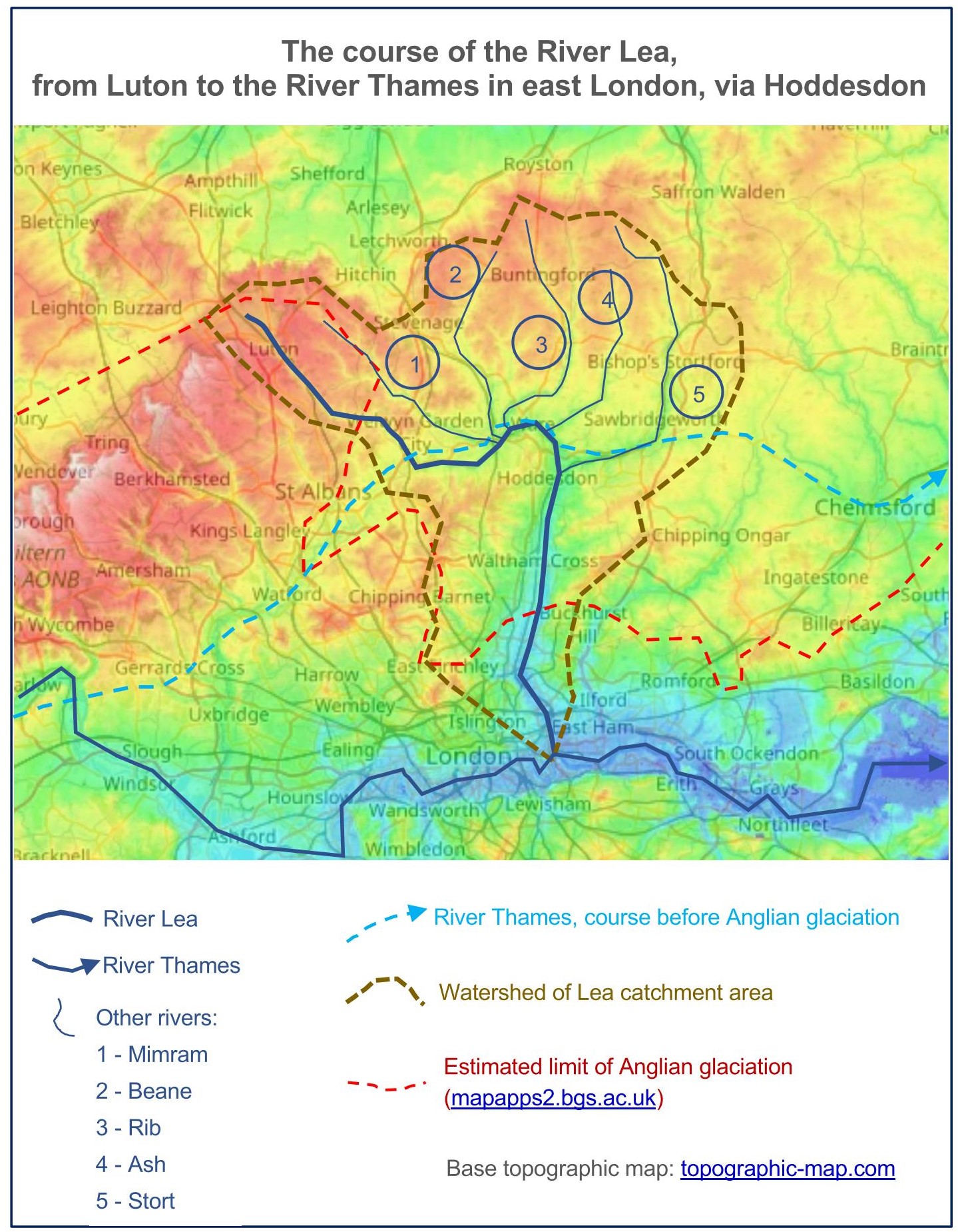
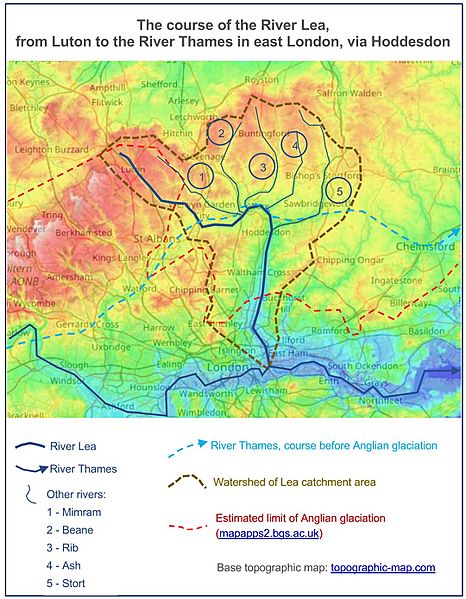
Description: The upper River Lea, and rivers which now flow into it near Hertford, were once tributaries of the River Thames. The Anglian glaciation diverted the Thames southwards and led to the creation of the lower River Lea. Base map from topographic-map.com, "Free topographic maps visualization and sharing."
Title: Lea Valley topographic map
Credit: Own work
Author: Alan Mattingly
Usage Terms: Creative Commons Attribution-Share Alike 4.0
License: CC BY-SA 4.0
License Link: https://creativecommons.org/licenses/by-sa/4.0
Attribution Required?: Yes
Image usage
The following page links to this image:

All content from Kiddle encyclopedia articles (including the article images and facts) can be freely used under Attribution-ShareAlike license, unless stated otherwise.