
Image: Lee County, Virginia
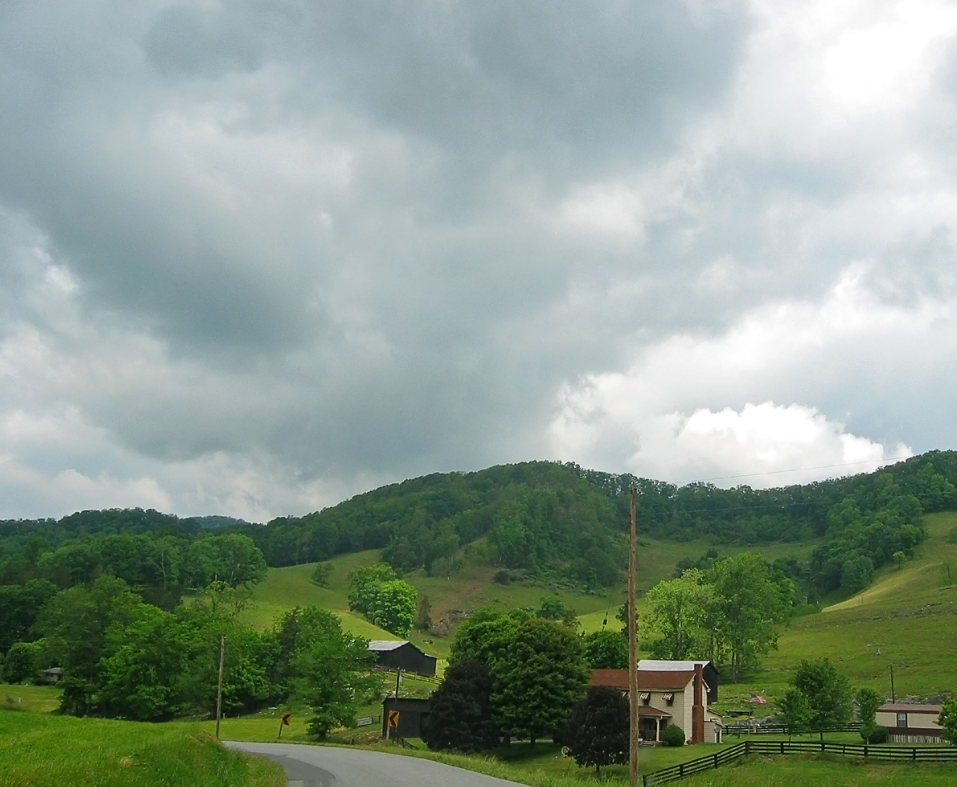
Description: I'm going through photos from last year's trip to Appalachia, to supplement my writing up of the roadtrip tale on my blog. This is yet another snapshot through the car window, taken somewhere near Pennington Gap, Virginia. I was driving from the town of Norton to the Cumberland Gap, by way of the town of Appalachia, Pennington Gap, and then a tiny road -- route 659 along the stream Sugar Run, I think. Finally I took highway 58 to Cumberland Gap. Given the size of the road in this photo, I'm guessing this is along route 659, several miles west of Pennington Gap. This local live map shows the approximate location. It had rained recently. The hills were surprisingly lush and green.
Title: Lee County, Virginia
Credit: Southwestern Virginia
Author: pfly from Pugetopolis
Usage Terms: Creative Commons Attribution-Share Alike 2.0
License: CC BY-SA 2.0
License Link: http://creativecommons.org/licenses/by-sa/2.0
Attribution Required?: Yes
Image usage
The following page links to this image:
