
Image: LigeiaRDR wiki lttl
No higher resolution available.
LigeiaRDR_wiki_lttl.png (711 × 462 pixels, file size: 93 KB, MIME type: image/png)
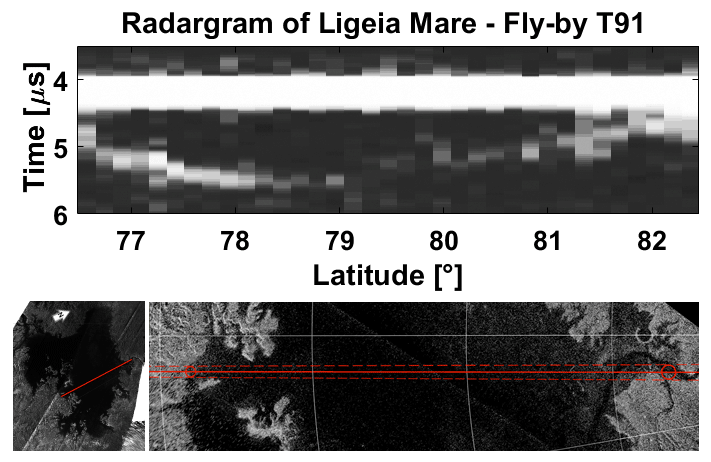
Description: Radargram acquired by the Cassini RADAR altimeter showing the surface and seafloor of Ligeia Mare along the transect highlined by the red line. In each column is shown the received power as function of time.
Title: LigeiaRDR wiki lttl
Credit: Own work
Author: Valerio Poggiali
Usage Terms: Creative Commons Attribution-Share Alike 3.0
License: CC BY-SA 3.0
License Link: http://creativecommons.org/licenses/by-sa/3.0
Attribution Required?: Yes
Image usage
The following page links to this image:

All content from Kiddle encyclopedia articles (including the article images and facts) can be freely used under Attribution-ShareAlike license, unless stated otherwise.