
Image: Limes4
Size of this preview: 645 × 599 pixels. Other resolutions: 258 × 240 pixels | 2,633 × 2,447 pixels.
Original image (2,633 × 2,447 pixels, file size: 999 KB, MIME type: image/png)
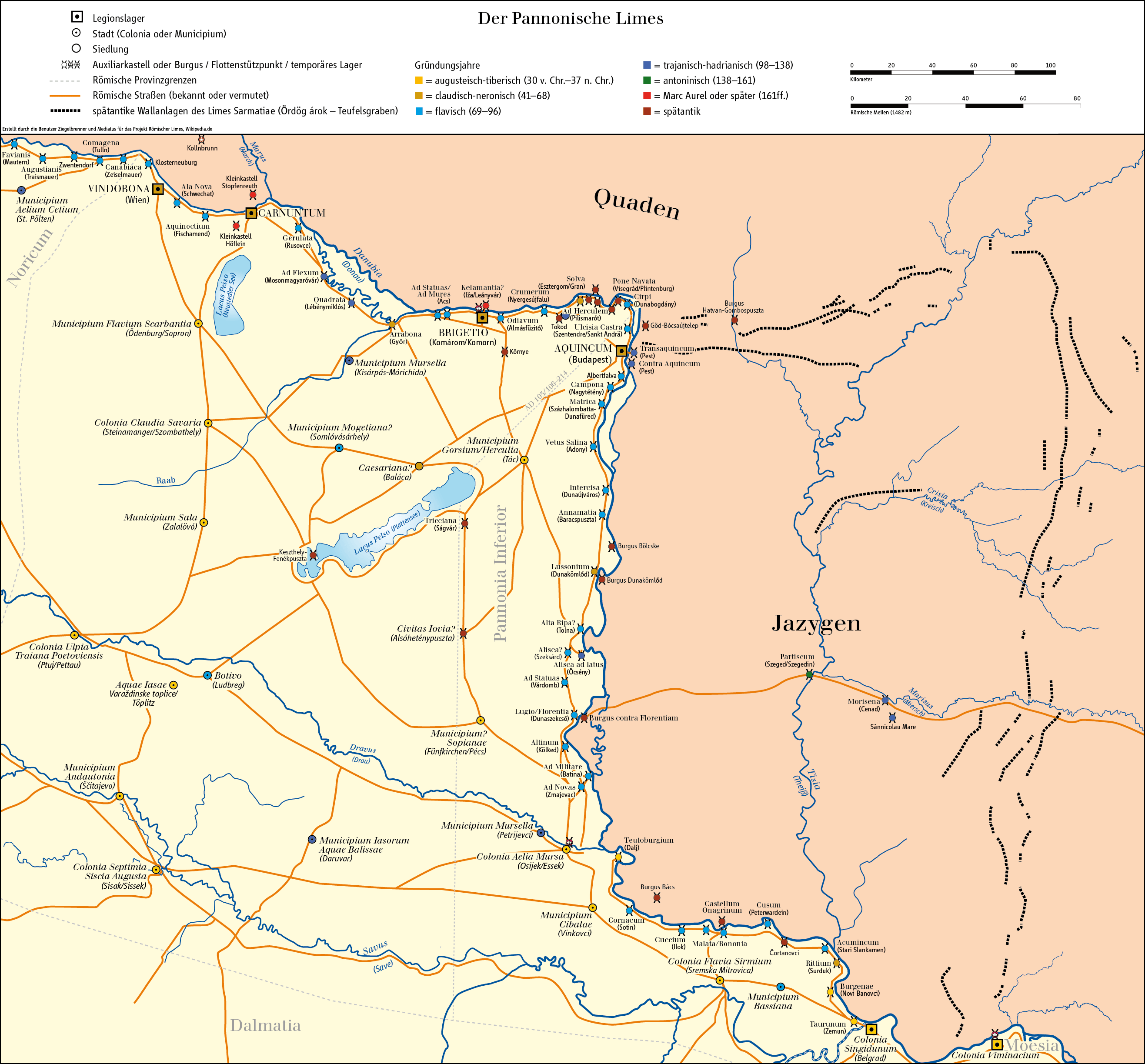
Description: Map of Limes in Austria, Slovakia, Hungary, Croatia and Serbia (Pannonia/system of fortifications representing the boundary of Roman control)
Title: Limes4
Credit: Own work/Source of Information: Putzger – Historischer Weltatlas, 89. Auflage, 1965; Westermanns Großer Atlas zur Weltgeschichte, 1978; weitere Quellen sind durch die Wikipedia-Artikel mit den jeweils angegebenen enzyklopädischen Quellen erschlossen.
Author: Ziegelbrenner & Mediatus
Usage Terms: Creative Commons Attribution-Share Alike 3.0
License: CC BY-SA 3.0
License Link: http://creativecommons.org/licenses/by-sa/3.0
Attribution Required?: Yes
Image usage
The following 2 pages link to this image:

All content from Kiddle encyclopedia articles (including the article images and facts) can be freely used under Attribution-ShareAlike license, unless stated otherwise.