
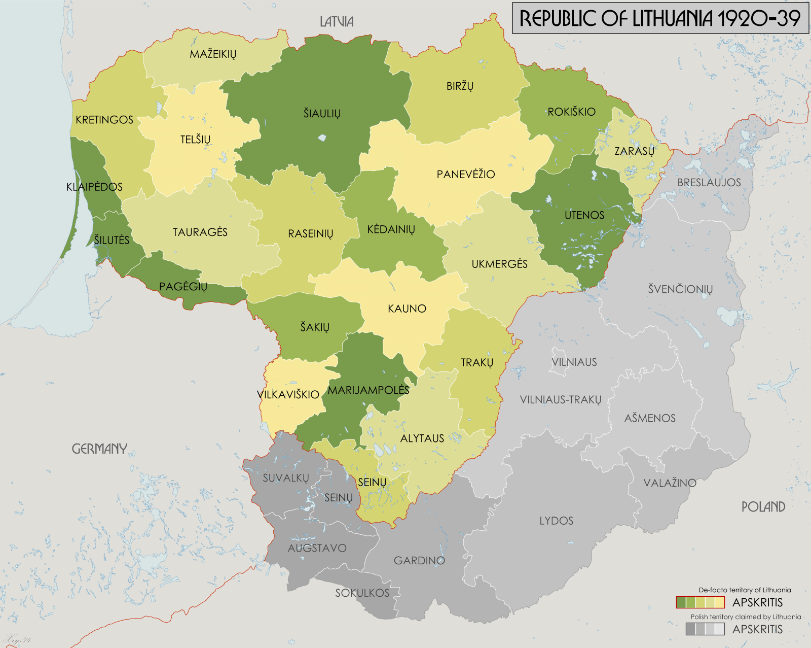
Image: LithuaniaCounties1918-1940
Size of this preview: 751 × 599 pixels. Other resolutions: 301 × 240 pixels | 1,600 × 1,277 pixels.
Original image (1,600 × 1,277 pixels, file size: 186 KB, MIME type: image/png)
Description: Administrative map of the counties of the Republic of Lithuania 1918-1940. Source data: "Badan Spraw Narodowosciowych" Jan 1919 (1:750k) courtesy of maps4u.lt. "Mapa Administracyjna Rzeczypospolitej Polskiej" (1:300k) courtesy of mapywig.org.
Title: LithuaniaCounties1918-1940
Credit: Own work
Author: XrysD
Usage Terms: Creative Commons Attribution-Share Alike 4.0
License: CC BY-SA 4.0
License Link: https://creativecommons.org/licenses/by-sa/4.0
Attribution Required?: Yes
Image usage
The following page links to this image:

All content from Kiddle encyclopedia articles (including the article images and facts) can be freely used under Attribution-ShareAlike license, unless stated otherwise.