
Image: Location map Long Island

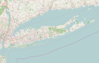
Description: Mappa di Long Island Limiti geografici della mappa: N: 41.43° S: 40.30° W: 74.12° E: 71.76°
Title: Location map Long Island
Credit: OpenStreetMap
Author: L9A8M
Permission: This file is licensed under the Creative Commons Attribution-Share Alike 2.0 Generic license. You are free: to share – to copy, distribute and transmit the work to remix – to adapt the work Under the following conditions: attribution – You must give appropriate credit, provide a link to the license, and indicate if changes were made. You may do so in any reasonable manner, but not in any way that suggests the licensor endorses you or your use. share alike – If you remix, transform, or build upon the material, you must distribute your contributions under the same or compatible license as the original. https://creativecommons.org/licenses/by-sa/2.0 CC BY-SA 2.0 Creative Commons Attribution-Share Alike 2.0 truetrue
Usage Terms: Creative Commons Attribution-Share Alike 2.0
License: CC BY-SA 2.0
License Link: https://creativecommons.org/licenses/by-sa/2.0
Attribution Required?: Yes
Image usage
The following 81 pages link to this image:
- Albertson, New York
- Amagansett, New York
- Amityville, New York
- Babylon, New York
- Baxter Estates, New York
- Bellerose, New York
- Bellmore, New York
- Brookhaven, New York
- Brooklyn
- Calverton, New York
- Cold Spring Harbor, New York
- Commack, New York
- East Meadow, New York
- East Quogue, New York
- Eatons Neck, New York
- Execution Rocks Light
- Freeport, New York
- Garden City, New York
- Greenport, Suffolk County, New York
- Hauppauge, New York
- Head of the Harbor, New York
- Hempstead, New York
- Hempstead (village), New York
- Herricks, New York
- Holtsville, New York
- Jamesport, New York
- Jericho, New York
- Lake Grove, New York
- Lake Ronkonkoma (lake)
- Lakeview, New York
- Laurel Hollow, New York
- Levittown, New York
- Lindenhurst, New York
- Lynbrook, New York
- Malverne, New York
- Manhasset, New York
- Manhasset Hills, New York
- Massapequa, New York
- Matinecock, New York
- Medford, New York
- Merrick, New York
- Mill Neck, New York
- Mineola, New York
- Montauk, New York
- Mount Sinai, New York
- Muttontown, New York
- Napeague, New York
- New Cassel, New York
- Oyster Bay (town), New York
- Oyster Bay Cove, New York
- Patchogue, New York
- Plandome, New York
- Port Jefferson, New York
- Queens
- Quogue, New York
- Rockville Centre, New York
- Rocky Point, New York
- Ronkonkoma, New York
- Roosevelt Field (airport)
- Roslyn, New York
- Roslyn Estates, New York
- Roslyn Harbor, New York
- Roslyn Heights, New York
- Sag Harbor, New York
- Sea Cliff, New York
- Searingtown, New York
- Selden, New York
- Setauket, New York
- Smithtown, New York
- Southold, New York
- Springs, New York
- Stony Brook, New York
- Syosset, New York
- Valley Stream, New York
- Wainscott, New York
- Wantagh, New York
- West Babylon, New York
- West Hills, New York
- West Islip, New York
- Westbury, New York
- Westhampton Beach, New York
