
Image: Location map of Ogle County, Illinois

Size of this PNG preview of this SVG file: 600 × 600 pixels. Other resolution: 240 × 240 pixels.
Original image (SVG file, nominally 768 × 768 pixels, file size: 236 KB)
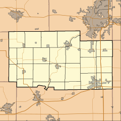
Description: This is a map of Ogle County, Illinois, USA which includes township borders.
Title: Location map of Ogle County, Illinois
Credit: My own work, using custom-written MapScript applications with National Atlas and United States Census Bureau data
Author: Omnedon
Usage Terms: Public domain
License: Public domain
Attribution Required?: No
Image usage
The following 24 pages link to this image:
- Adeline, Illinois
- Baileyville, Illinois
- Brookville, Illinois
- Buffalo Grove, Ogle County, Illinois
- Byron, Illinois
- Chana, Illinois
- Creston, Illinois
- Davis Junction, Illinois
- Daysville, Illinois
- Egan, Illinois
- Flagg, Illinois
- Forreston, Illinois
- Grand Detour, Illinois
- Hillcrest, Illinois
- Kings, Ogle County, Illinois
- Lindenwood, Illinois
- Monroe Center, Illinois
- Mount Morris, Illinois
- Oregon, Illinois
- Paynes Point, Illinois
- Polo, Illinois
- Rochelle, Illinois
- Stillman Valley, Illinois
- Woosung, Illinois

All content from Kiddle encyclopedia articles (including the article images and facts) can be freely used under Attribution-ShareAlike license, unless stated otherwise.