
Image: Location map of Passaic County, New Jersey

Size of this PNG preview of this SVG file: 700 × 600 pixels. Other resolution: 280 × 240 pixels.
Original image (SVG file, nominally 896 × 768 pixels, file size: 418 KB)
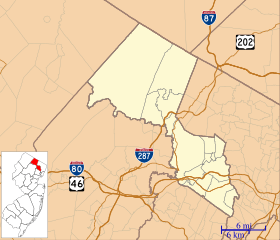
Description: This is a map of Passaic County, New Jersey, USA which includes incorporated settlements, township borders, and major highways.
Title: Location map of Passaic County, New Jersey
Credit: My own work, using custom-written MapScript applications with United States Census Bureau data
Author: Omnedon
Usage Terms: Public domain
License: Public domain
Attribution Required?: No
Image usage
The following 28 pages link to this image:
- Cathedral of St. John the Baptist (Paterson, New Jersey)
- Cathedral of St. Michael the Archangel (Passaic, New Jersey)
- Clifton, New Jersey
- Dey Mansion
- Downtown Paterson
- Dundee Canal
- Garret Mountain Reservation
- Goffle Brook Park
- Great Falls (Passaic River)
- Great Notch, New Jersey
- Greenwood Lake
- Haskell, New Jersey
- Hawthorne, New Jersey
- Hewitt, New Jersey
- Hinchliffe Stadium
- Lambert Castle
- Macopin, New Jersey
- Newfoundland, New Jersey
- Oak Ridge, New Jersey
- Passaic County Court House
- Paterson, New Jersey
- Pietro and Maria Botto House
- Pines Lake, New Jersey
- Preakness, New Jersey
- Ringwood Manor
- Skylands (estate)
- U.S. Animal Quarantine Station
- Van Riper–Hopper House

All content from Kiddle encyclopedia articles (including the article images and facts) can be freely used under Attribution-ShareAlike license, unless stated otherwise.