
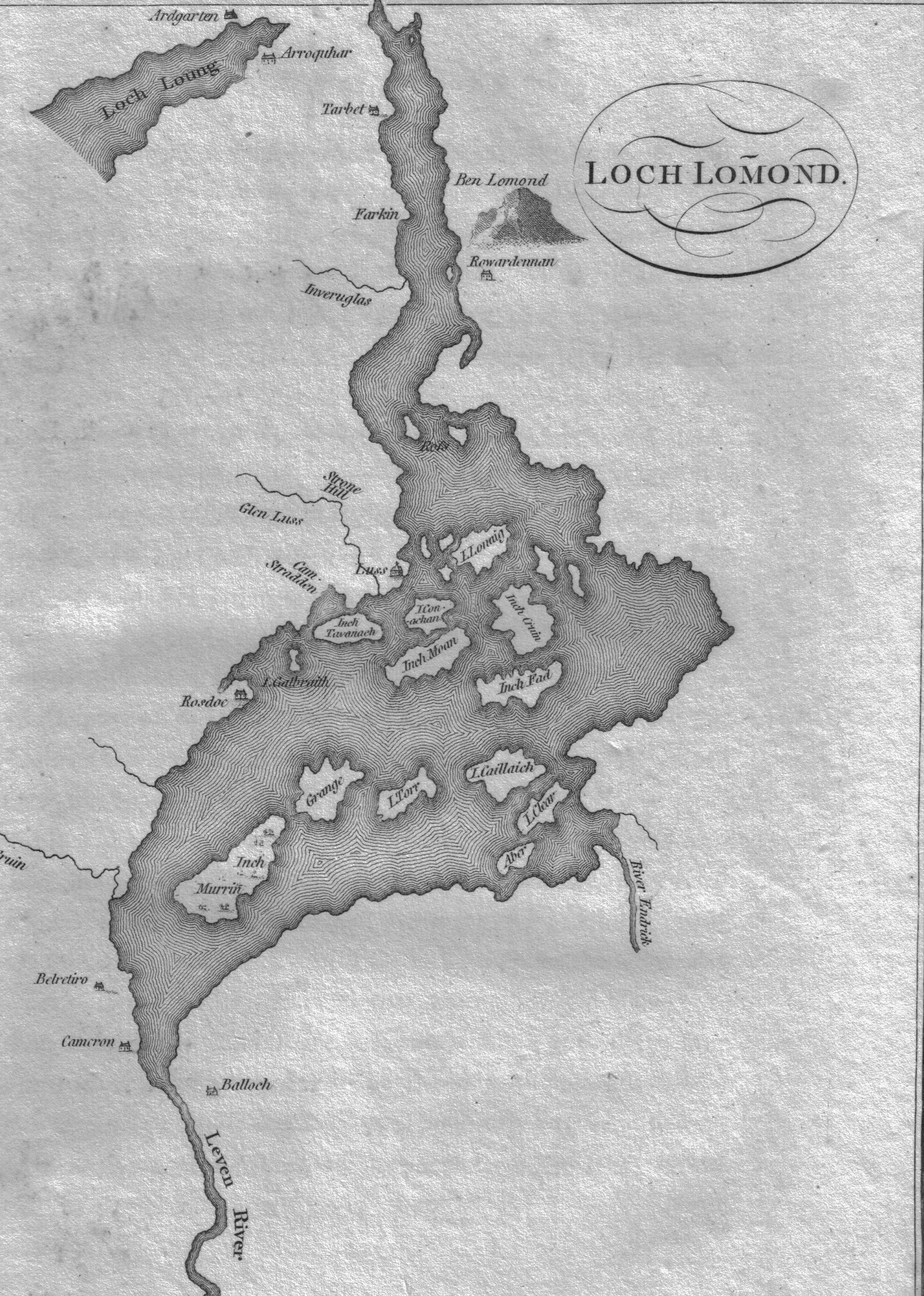
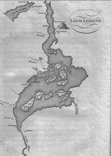
Image: Loch Lomond Map c 1800
Size of this preview: 427 × 599 pixels. Other resolutions: 171 × 240 pixels | 3,616 × 5,072 pixels.
Original image (3,616 × 5,072 pixels, file size: 3.82 MB, MIME type: image/jpeg)
Description: A map of Loch Lomond showing the islands and rivers. Circa 1800. Scotland.
Title: Loch Lomond Map c 1800
Credit: Garnetts Tour of Scotland. 1800. Presence suggested by Google books
Author: Roger Griffith
Usage Terms: Public domain
License: Public domain
Attribution Required?: No
Image usage
The following 5 pages link to this image:

All content from Kiddle encyclopedia articles (including the article images and facts) can be freely used under Attribution-ShareAlike license, unless stated otherwise.