
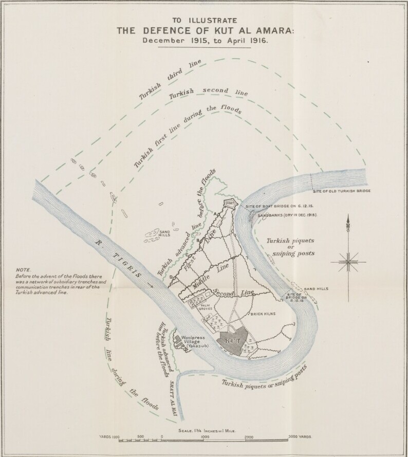
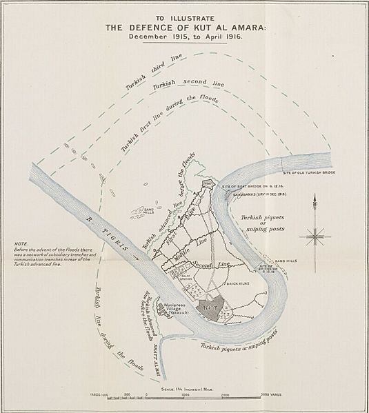
Image: MAP TO ILLUSTRATE THE DEFENCE OF KUT AL AMARA December 1915, to April 1916
Description: The map accompanies The Campaign in Mesopotamia 1914-1918. Volume II , and shows a region around Kut [Al Kūt] in central and eastern Iraq, indicating military operations, fortifications, built-up areas, roads, palm groves and watercourses. A short note describes Turkish fortifications.
Title: MAP TO ILLUSTRATE THE DEFENCE OF KUT AL AMARA December 1915, to April 1916
Credit: https://www.qdl.qa/en/archive/81055/vdc_100025551852.0x000001
Author: East India Company, the Board of Control, the India Office, or other British Government Department
Usage Terms: Open Government License 2
License: OGL 2
License Link: http://www.nationalarchives.gov.uk/doc/open-government-licence/version/2
Attribution Required?: Yes
Image usage
The following page links to this image:
