
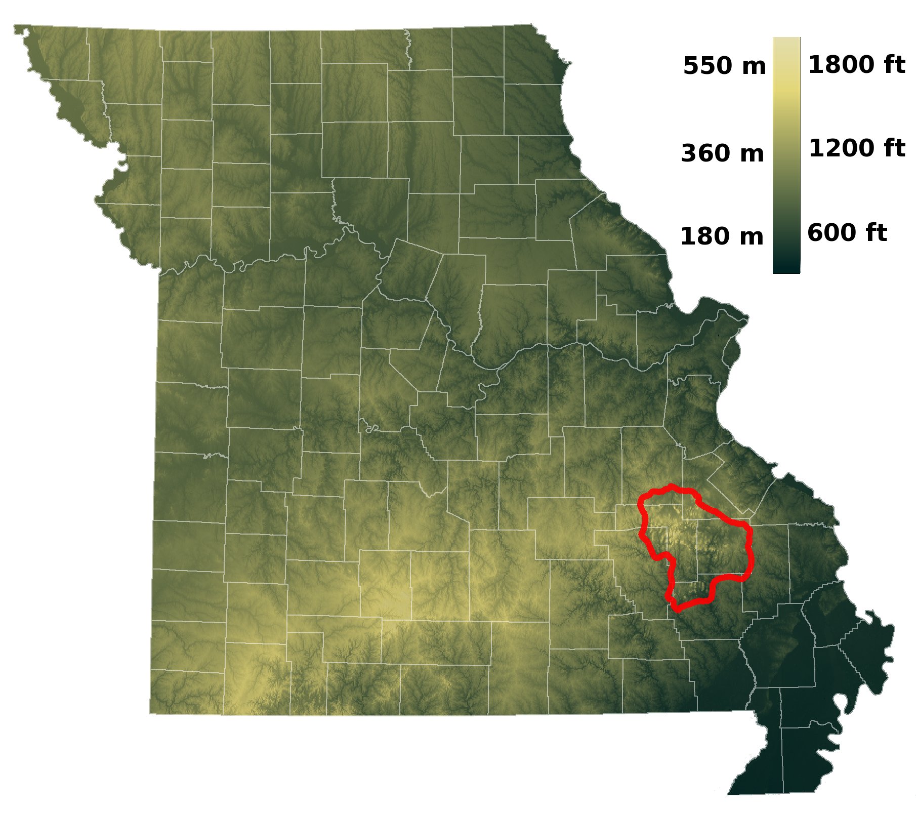
Image: MO relief St Francois Mtns
Size of this preview: 676 × 600 pixels. Other resolutions: 271 × 240 pixels | 1,810 × 1,606 pixels.
Original image (1,810 × 1,606 pixels, file size: 340 KB, MIME type: image/jpeg)
Description: Shaded relief map of Missouri showing the location of the St. Francois Mountains. Created from 3-arcsecond resolution SRTM elevation data. Geophysical boundaries from Missouri Spatial Data Information Service[1]: dataset metadata
Title: MO relief St Francois Mtns
Credit: Own work
Author: Kbh3rd
Usage Terms: Creative Commons Attribution-Share Alike 3.0
License: CC BY-SA 3.0
License Link: https://creativecommons.org/licenses/by-sa/3.0
Attribution Required?: Yes
Image usage
The following page links to this image:

All content from Kiddle encyclopedia articles (including the article images and facts) can be freely used under Attribution-ShareAlike license, unless stated otherwise.