
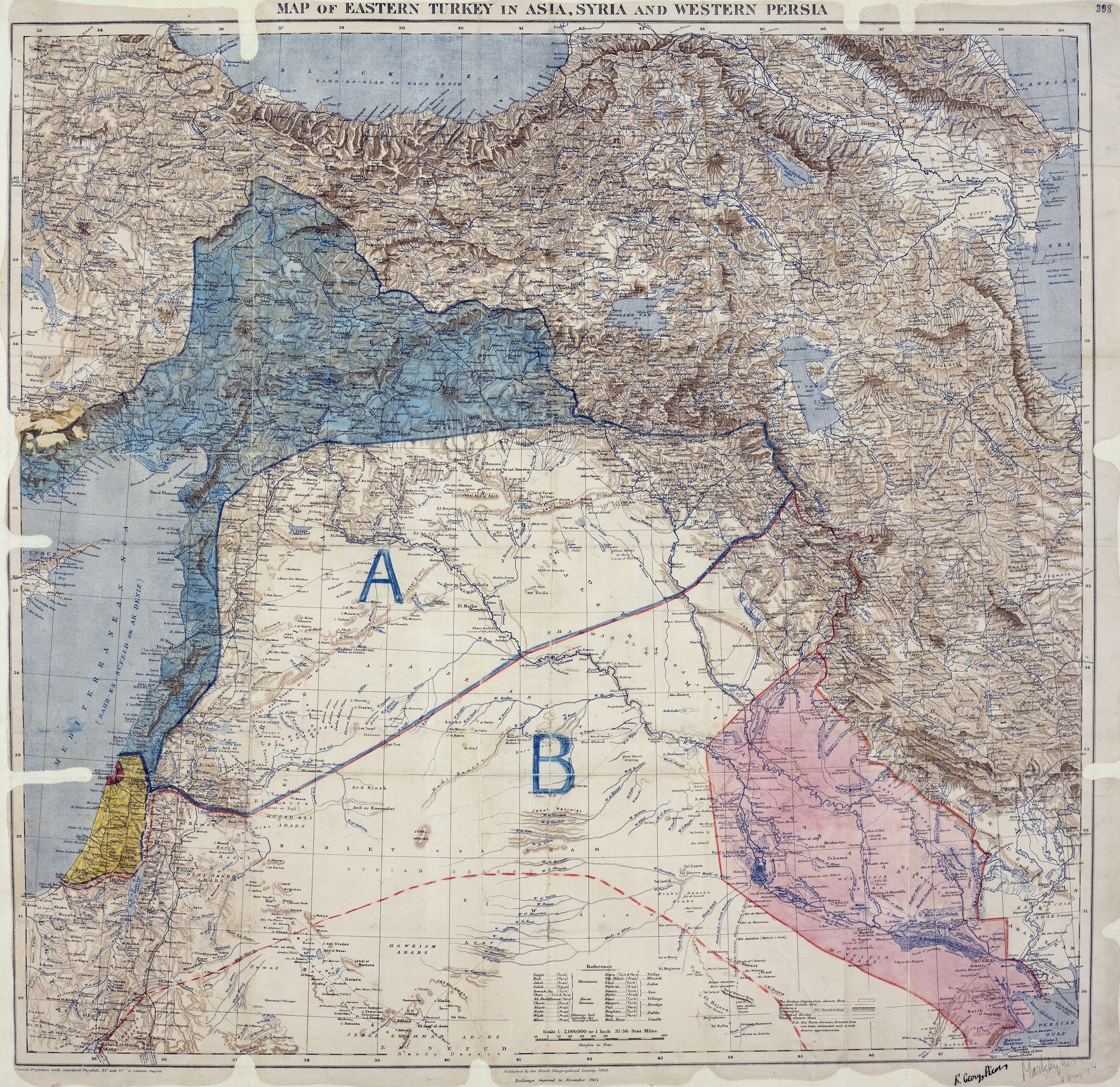
Image: MPK1-426 Sykes Picot Agreement Map signed 8 May 1916
Description: Map of Sykes–Picot Agreement showing Eastern Turkey in Asia, Syria and Western Persia, and areas of control and influence agreed between the British and the French. Royal Geographical Society, 1910-15. Signed by Mark Sykes and François Georges-Picot, 8 May 1916.
Title: MPK1-426 Sykes Picot Agreement Map signed 8 May 1916
Credit: This file is from the collections of The National Archives (United Kingdom), catalogued under document record MPK1/426. For high quality reproductions of any item from The National Archives collection please contact the image library. This tag does not indicate the copyright status of the attached work. A normal copyright tag is still required. See Commons:Licensing for more information. English | français | italiano | македонски | +/−
Author: Royal Geographical Society (Map), Mark Sykes & François Georges-Picot (Annotations)
Usage Terms: Public domain
License: Public domain
Attribution Required?: No
Image usage
The following 2 pages link to this image:
