
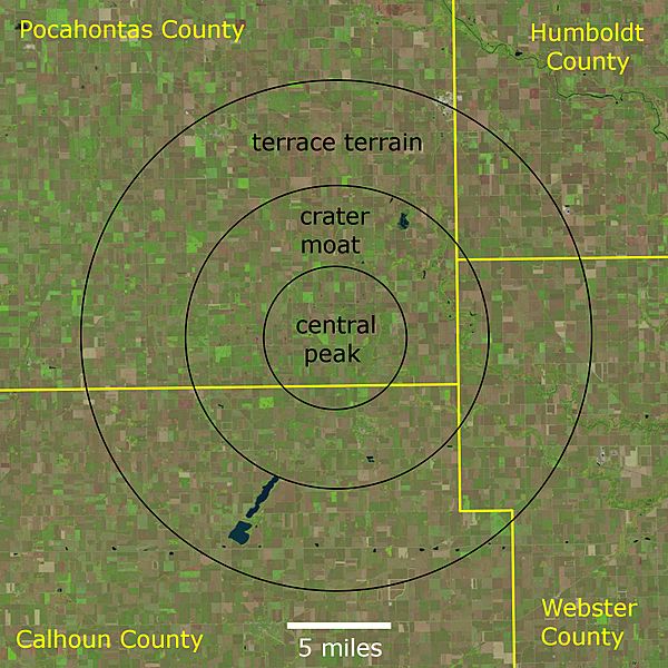
Image: Manson crater landsat map

Description: Map of the Manson impact structure in northwestern Iowa, United States. Based on Figure 1 of Geology, geophysics, and geochronology of the Manson impact structure. by Hartung, J. B., Kunk, M.J. and Anderson, R.R., in Global Catastrophes in Earth History, Geological Society of America, Special Paper 247, pp. 207-221. 1990. Landsat images dated 04 October 2021, downloaded from EarthExplorer: LC08_CU_017007_20210922_20211004_02 LC08_CU_018007_20210922_20211004_02
Title: Manson crater landsat map
Credit: Own work
Author: Jstuby
Usage Terms: Creative Commons Zero, Public Domain Dedication
License: CC0
License Link: http://creativecommons.org/publicdomain/zero/1.0/deed.en
Attribution Required?: No
Image usage
The following page links to this image:
